Originally published on X on 30 June 2024.


Poříčí – meaning ‘Riverside’ – existed as a settlement by the year 1000 (its local church was mentioned in writing in 993: https://whatsinapraguestreetname.com/2024/11/10/prague-1-day-261-klimentska/).
It was mainly settled by German merchants, as demonstrated by the name of the trade route leading through it – Vicus Teutonicum.
A second church, St Peter’s, was added in the mid-eleventh century, and by 1200, Soběslav II gave Poříčí the right to limited self-government.
The history of Poříčí as a separate settlement ended in 1348, when most of it was incorporated into Prague’s New Town.
Around that time, the street still consisted of two parts – the western side was called Slaměná, as straw (sláma) was sold around there, and the eastern side was called Šilinkova, after New Town mayor František Šilinek.
The two streets were united as Poříčská around 1850, then becoming known as Na Poříčí in 1894.
It’s a street that I mainly associate with errands and getting from A to B, but it deserves more attention than that.
If you start on the corner with Náměstí Republiky, you’ve got the former stables of the former barracks, now integrated into the Palladium shopping centre (https://whatsinapraguestreetname.com/2024/11/10/prague-1-day-267-namesti-republiky-republic-square/).
At number 12, there’s the modern classicist Palác YMCA, built in 1928 by the architect Eduard Hnilička. Originally offering 300 beds in 170 rooms, it was a secret meeting place for the Czech Resistance when the Nazis occupied Bohemia and Moravia.
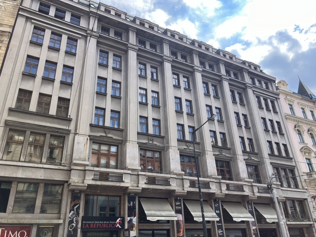
The YMCA was forced to vacate in 1941, and was officially closed down in 1943; reopened after the Prague Uprising (in which it was badly damaged), it functioned again until 1951, when it was closed until 1991.
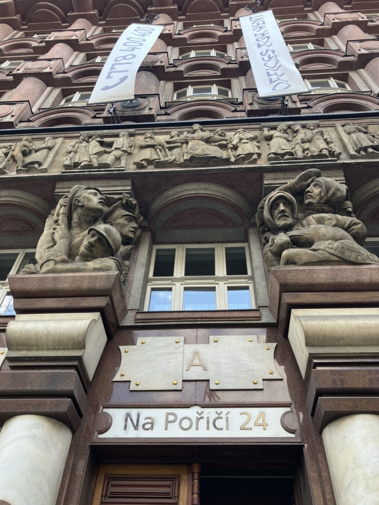
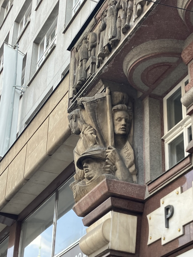
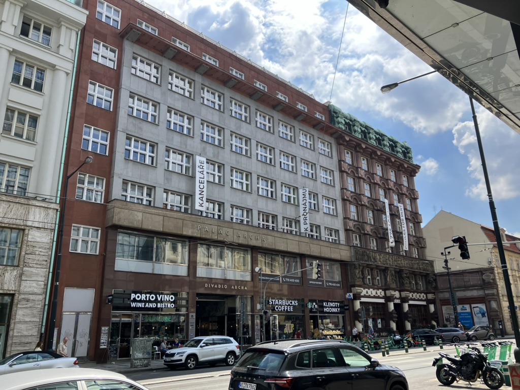
From 1937 until its dissolution, the Bank of the Czechoslovak Legions / Legiobanka had its headquarters in the rondocubist building at number 24, designed by Josef Gočár (on the right).
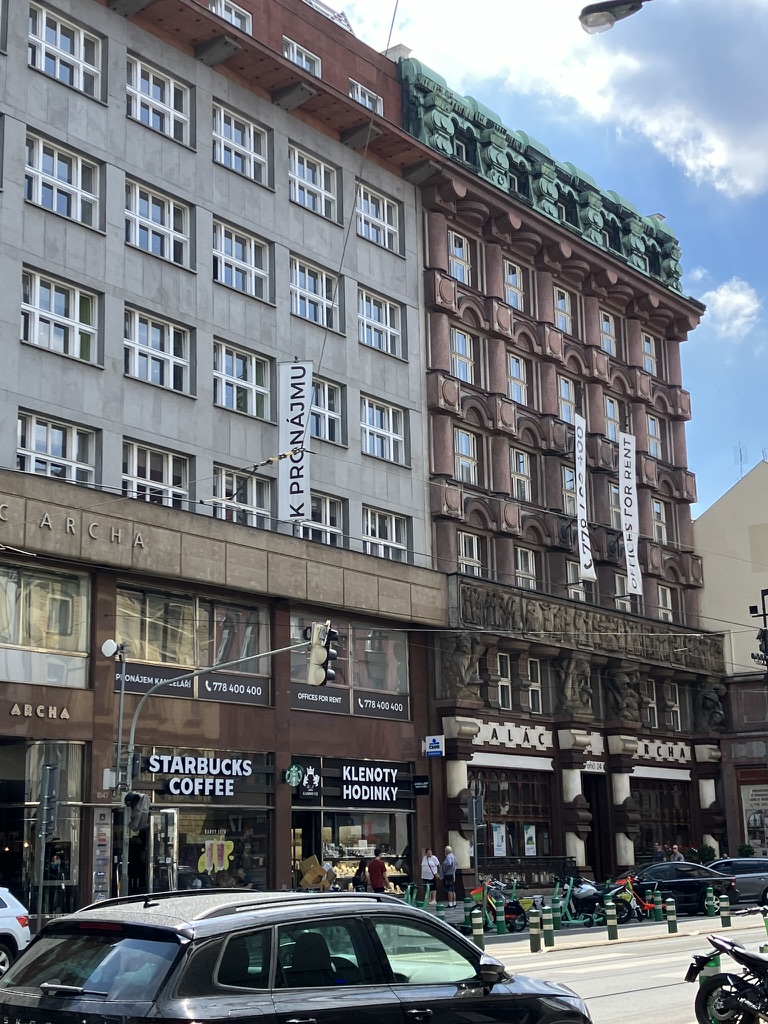
It’s called Palác Archa, and I’d happily start a Twitter account in which I publish nothing but pictures of its façade from different angles until the end of time.

It’s now used by Československá obchodní banka, a.s. (ČSOB), and, while I gather its insides are also quite spectacular, it’s closed at weekends, hence this rather disappointing photo.

Next door, there’s Divadlo (Theatre) Archa, which sadly closed down in 2023.
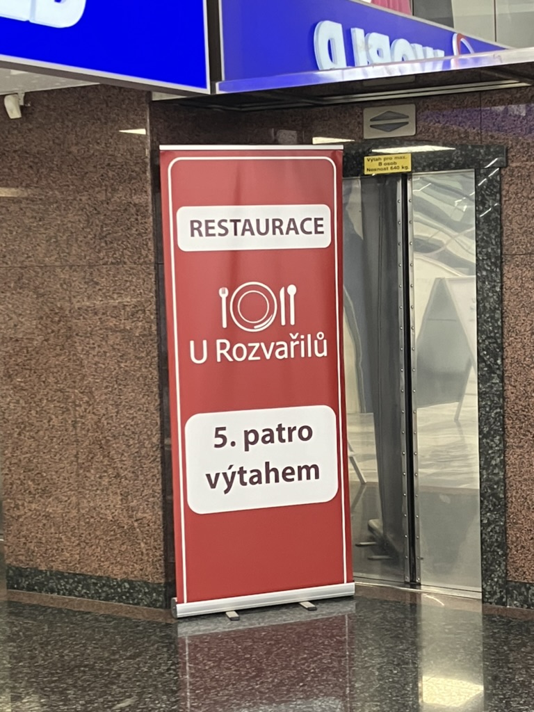
It was also once the home of U Rozvařilů, a restaurant able to trace its origins back to the 15th century. The restaurant (pictured in 1939) even had a cabaret for many decades, but was forced to move out by the owners of the building in 2008.

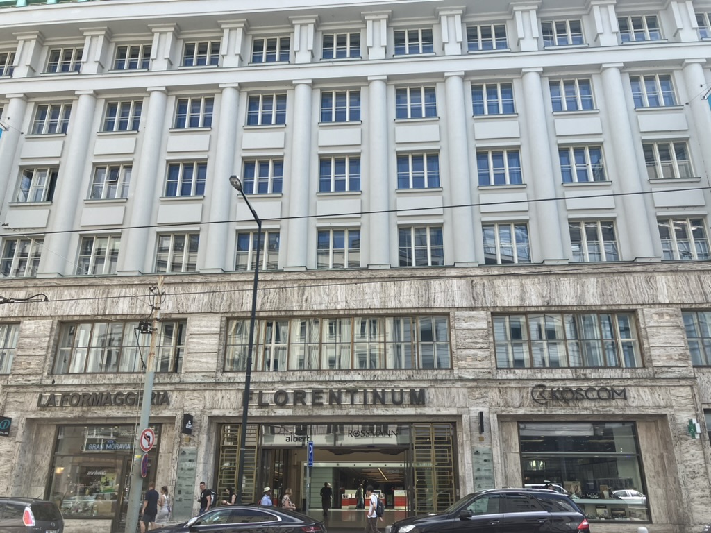
Number 30 hosts the Florentinum, a shopping centre, and also makes for a more imposing photo than you’d have thought.
But, on the other side, there’s a much more famous shopping centre – Bílá labuť (White Swan), the most modern store of its kind in Central Europe when it opened in 1939.

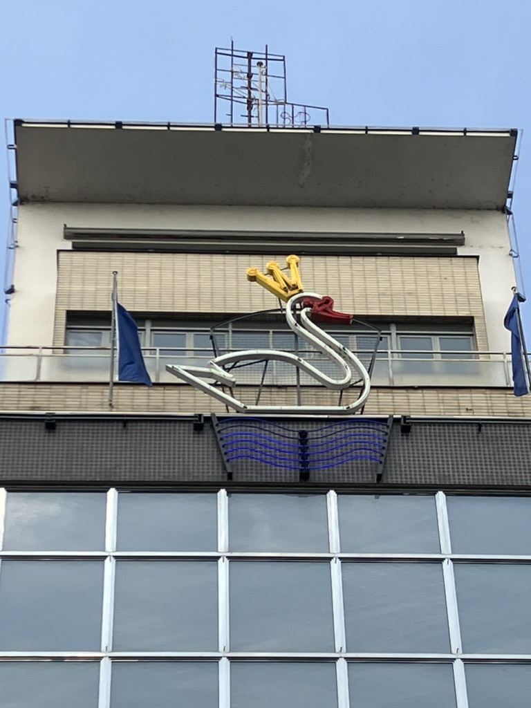
It certainly can’t claim that title these days, but it did allow U Rozvařilů (see above) to move just across the road after being shut out of its long-term home in 2008, so that’s a good thing.
The insides aren’t really built in a way that allows you to take photos that show very much of it at once (not that this is the purpose of a shopping centre, I do realise).


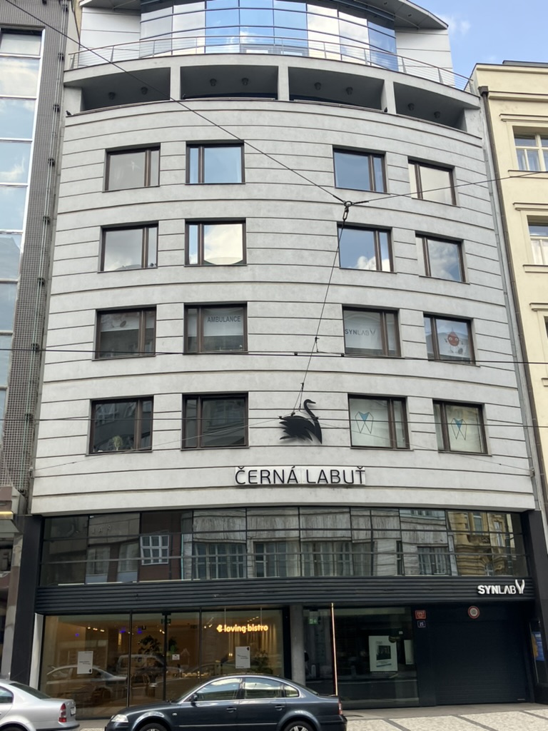
Pleasingly, the White Swan has a Black Swan as its neighbour.
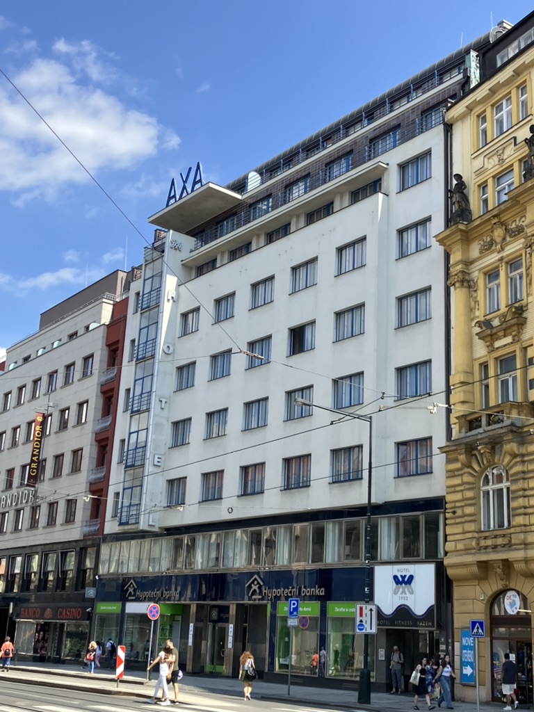
Continuing the functionalist feeling of much of the street, the Hotel AXA was built between 1930 and 1932 by Václav Pilec; it was returned to the family (specifically his granddaughter) in 1994, and renovated from 2013-4.

Leave a comment