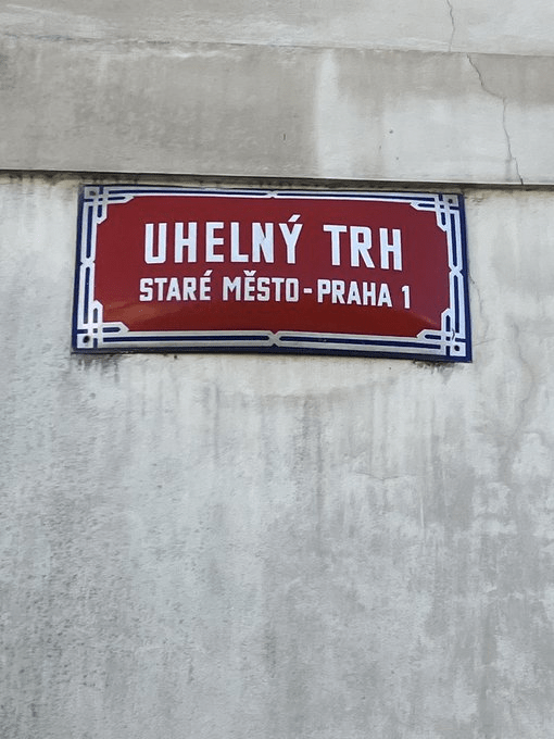
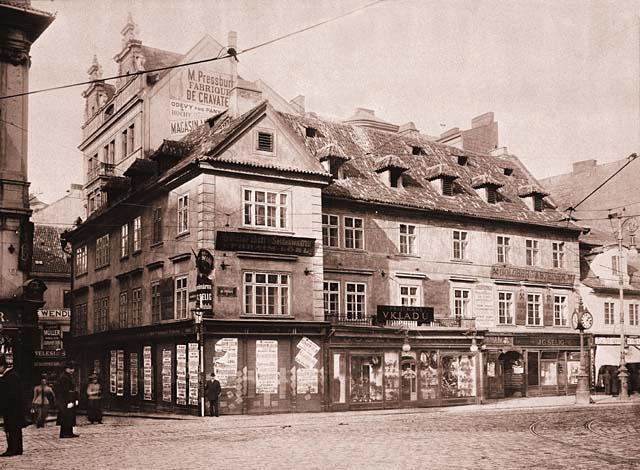
Uhlí is coal; a trh is a market. Coal made from wood is charcoal, and, in Czech, that’s dřevěné uhlí (literally ‘wooden coal’).
Sales of charcoal took place until the 1800s, when hard coal became more popular.
Uhelný trh became a place you’d go to to buy soup and other hot meals, as well as flowers. Meanwhile, the smelter that was in the centre of the square until 1807 was disposed of.
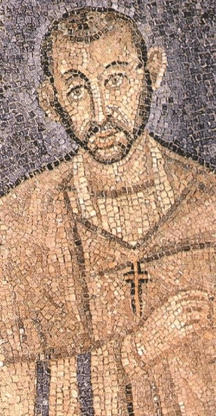
Which was twenty years after a young composer from Austria had stayed at number one on the square. His name was Wolfgang Amadeus Mozart.
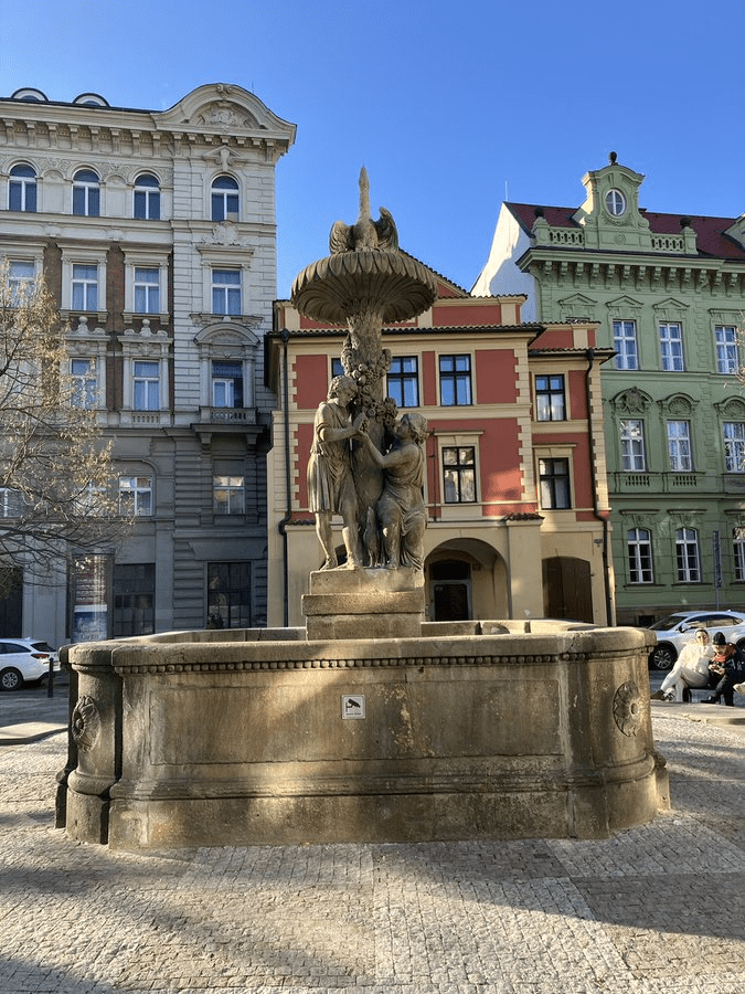
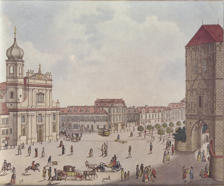
In the 1830s, a fountain was placed where the smelter had been; it was removed in 1894, and what you see now is the Wimmer Fountain, which was added in 1951.
The house behind the fountain is the only ancient building on the square that still exists; it’s called U tří stupňů (The Three Degrees) and used to be a cafe, mainly frequented by those who worked at the market.
Meanwhile, you can see the original fountain – somewhat less grand – in this photo.
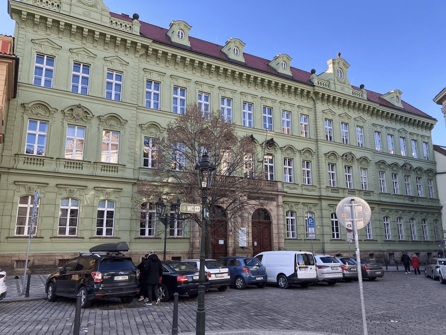
The school building on the square was the scene of an incident we’d rather forget.
It happened on 15 March 1939, also the day that President Emil Hácha signed away Czechoslovakia’s independence to Nazi Germany.
The Mussolini-inspired National Fascist Community (NOF) – which had never won more than 2% of the vote – occupied the building, and asked its supporters to occupy others in Prague. This was meant to be in support of the German occupiers, not against them.
However, NOF was vehemently anti-Germany, whoever was in power there, and the occupiers (of Bohemia and Moravia) managed to get the occupiers (of the school) out within three days. The NOF had ceased to exist by the end of 1939.
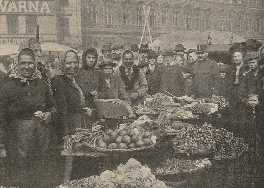
In order to end this post on a more positive note, here’s a great people of people going to / working at the market in 1906.
Between 1178 and 1187, the Church of St Martin was built, and, after that, the name of the settlement was updated to Újezd u Svatého Martina.
St Martin is Martin of Tours, actually from Pannonia (modern-day Hungary), but also the third Bishop of Tours, and later the patron saint of the French Third Republic.
In the 1230s, Václav I had city walls built. One result was that the southern side of the church was built into these; another was that the church became known as Kostel svatého Martina ve zdi (Church of St Martin in the Wall).
This also resulted in most of Újezd being placed outside the walls of the Old Town (the church being the obvious exception).
St Martin also got a gate named after him (yes, yes, it’s a shame nobody gives guided Tours of these, etc., etc.).
The church got a Gothic makeover in the 1350s; as it was used by Hussites in the 1400s, it was one of the few churches that was spared from destruction in the Hussite Wars.
It wasn’t so lucky in 1784, when it was abolished by Joseph II; subsequently, it was converted into residential space (photo from 1890 by Jindřich Eckert).
Reconstruction took place in 1905, going back to the Gothic style; archaeological finds from the original church were transferred to the City Museum.
Martinská also features one of the entrances to the courtyard of Palác Platýz. I know I mentioned this on the Národní post, but it’s worth highlighting again as it’s been nicely reconstructed.
There was a gate on the southern side of the street, leading to the monastery, so the street became known as ‘U fortny k Panně Marii Sněžné’, or for those who didn’t feel like saying that all the time, ‘U fortny’ (fortna being derived from the German Pforte).
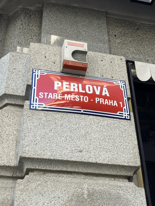
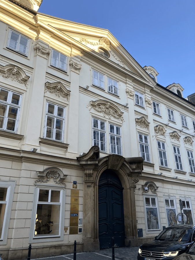
In 1641, one Vojtěch Had z Proseče bought a house on the street. He was ennobled in 1649, and decided to be known as Vojtěch Had z Proseče a z Perlštejna.
That last addition to his name is the most likely reason for the street now being called Perlová.
Number 10 – clearly not the version that Sir Had lived in – was, from 1865, the first headquarters of the Mortgage Bank of the Kingdom of Bohemia / Hypoteční banka Království českého.
There wasn’t any sign of this when I was there recently, but there was a man who was very stressed and in a hurry, and who got very sweary when I (a few metres in front of him) stopped to take some photos of buildings and he couldn’t get past (note: he could).
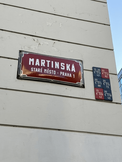
Originally published on X on 15 February 2024. That street sign needs a clean.
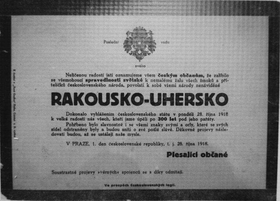
On 28 October 1918, a delegation of the Czechoslovak National Committee was in Geneva, as was Edvard Beneš, not a member, but the most prominent member of the anti-Austrian resistance.
They agreed that a Czechoslovak Republic should be created, with Tomáš Garrigue Masaryk (still in the USA) as President, and Karel Kramář – founder of the Committee – as Prime Minister.
Back in Prague, two members of the Committee, Antonín Švehla (later a three-time Prime Minister) and František Soukup (soon to be Czechoslovakia’s first Minister of Justice), went to Václavské náměstí, specifically to where Lucerna is now (https://whatsinapraguestreetname.com/2024/09/15/prague-1-day-114-vodickova/).
The reason? This was the location of the Prague branch of the War Grain Institute, and Švehla and Soukup wanted to stop grain from being transported to the front (they also made the staff working there swear allegiance to the soon-to-be-formed state).
On the same day, Austria-Hungary said it was going to recognise the autonomy of the peoples living in the Empire; people took this to mean that the Empire was acknowledging Czechoslovakia’s independence, and took to the streets (not just in Prague, of course) to celebrate.
And to tear down / paint over / burn stuff that reminded them of that Empire.
Meanwhile, Isidor Zahradník, a priest, gave a speech by the statue of Svatý Václav Plus Horse and declared that Czechoslovakia was now a reality.
In the evening, the National Committee issued the Act on the Establishment of an Independent Czechoslovak State.
Its signatories – Antonín Švehla, Alois Rašín (whose writing this is), Jiří Stříbrný, Vavro Šrobár and František Soukup – would come to be known as the Muži 28. října / Men of October 28.
This patriotic walk would start a bit further east if Na příkopě had been given a nice new Czechoslovak name too, though.
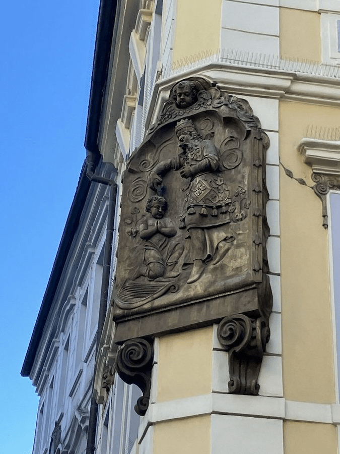
It’s fair to say that 28. října is the least scenic of all these streets, but it does include the corner of U Zlatého úlu (The Golden Beehive), probably the oldest building on Václavák (reconstruction from 1789).
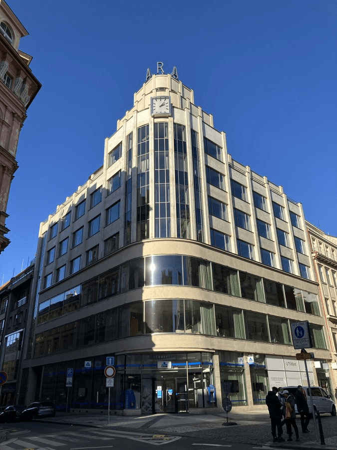
Whereas the functionalist Palác ARA (1930-1; done up in 2018-9) used to be a shopping centre, known as OD Perla during communism and, at times, giving (the earlier) Kotva and Bílá labuť a run for their money.
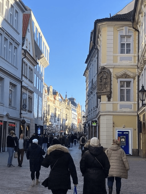
Also in the 13th century, there was a town near here called Havelské město (later incorporated into the Old Town, but getting its own post soon enough). And, on the north side of the bridge, there was a gate, appropriately called Havelská brána.
The street itself was created around 1330 as the principal access to Havelské město. It’s interesting that the name ‘Na můstku’ has been in use ever since, given that this was only one of thirteen gate-bridge combos in the Old Town fortifications.
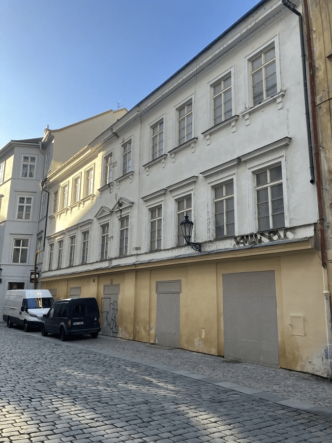
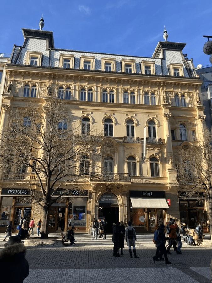
Provaznická is pretty empty, especially for such a central street, but it does feature the backside of Wimmerův palác (more on this – and a better-kept frontside – when we get to Rytířská).
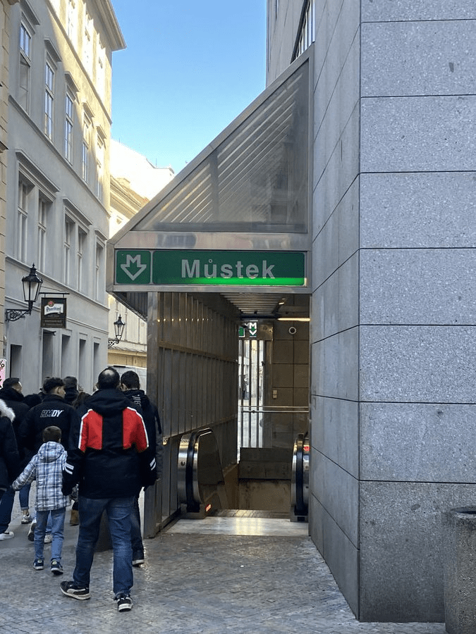
You can also hop onto the metro here if you want. And, to find out why Můstek is called Můstek, tune in tomorrow.
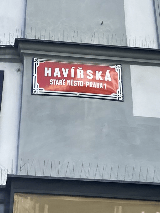
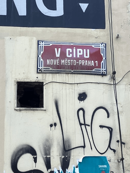
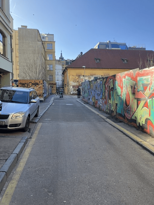
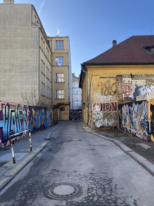
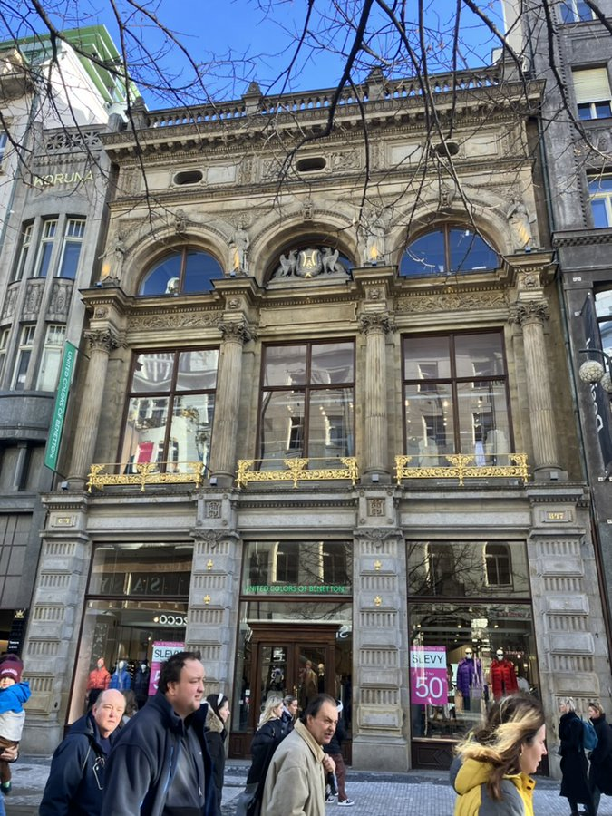
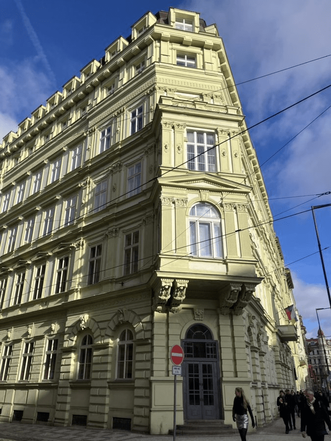
V Cípu has to be a contender for ‘least attractive street in Prague 1’. Even the houses refuse to look out onto it.
I didn’t feel unsafe per se when walking down it to take these pictures, but I didn’t feel sorry to no longer be on the street a couple of minutes later either.
The oldest documented name for this street, around 1380, is Nová (New) – because, sometimes, these street names just aren’t that creative.
On the corner with Na Příkopě, there was once land and gardens belonging to – great word alert – a maltman called Kříž or Křížalova, which led to the street being renamed Křížalova in 1680.
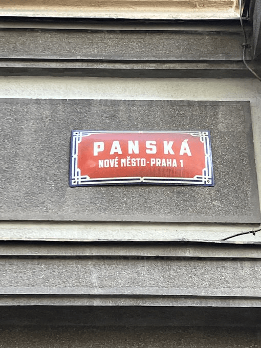
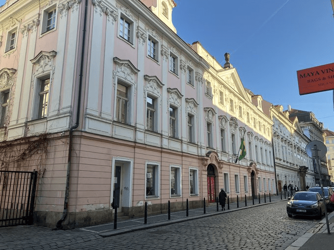
After Bílá Hora (1620), this street became a popular place for the nobility to buy up properties which had presumably been confiscated from non-Catholics – hence the street being known as Panská from the 1700s onwards (a pán is a sir, master, lord, gentleman, etc.).
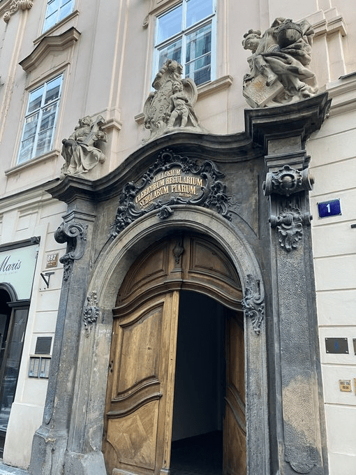
The third name was Piaristická. The Piarists are a religious order who are All About The Education; they arrived in Prague during the reign of Maria Theresa, and set up a school here in 1766. It’s about 17 paragraphs into this thread: https://whatsinapraguestreetname.com/2024/09/22/prague-1-day-137-na-prikope/.
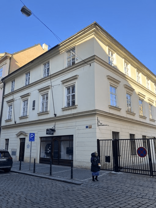
From Panská itself, its entrance (at number one) looks like this, while, nowadays, number 3 is the Secondary Technical School of Communication Technology.
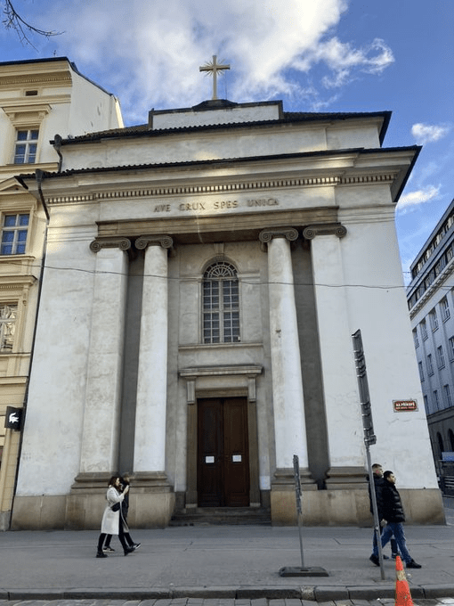
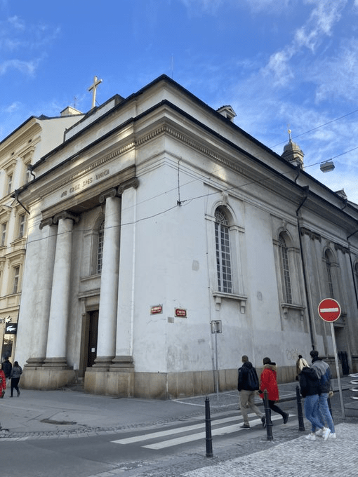
The Piarists also made a financial contribution for a church to be built across the road – the Church of the Holy Cross was completed in 1824.
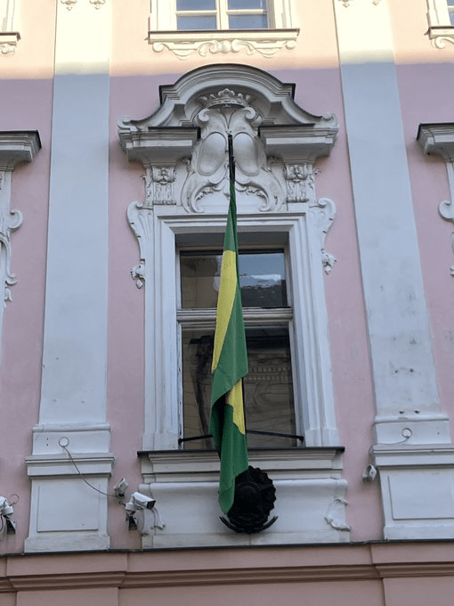
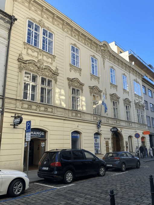
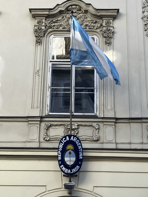
Panská also has embassies for two countries which, between them, cover almost two thirds of their continent’s landmass: Neubergovský palác, at number 5, is Brazil’s, while Palác Riesů ze Stallburgu, at number 6, is Argentina’s.
Whereas Kounický palác, at number 7, contains the Alfons Mucha Museum, and, in 1946, was the first Prague home of the British Council.
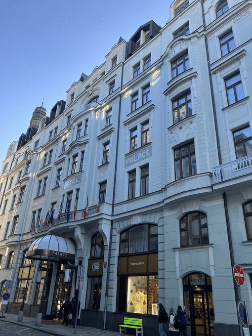
Millesimovský palác, at number 8, used to be an office for the Prager Tagblatt, a liberal-democratic newspaper which, despite being in German, was forced to close when the Nazis occupied Bohemia and Moravia in 1939.
Look between the first two lower windows, and you’ll see a plaque dedicated to the famous journalist Egon Kisch. You feel this building should be put to a good use, but apparently it’s due to be destroyed instead. So much for cultural monument status.
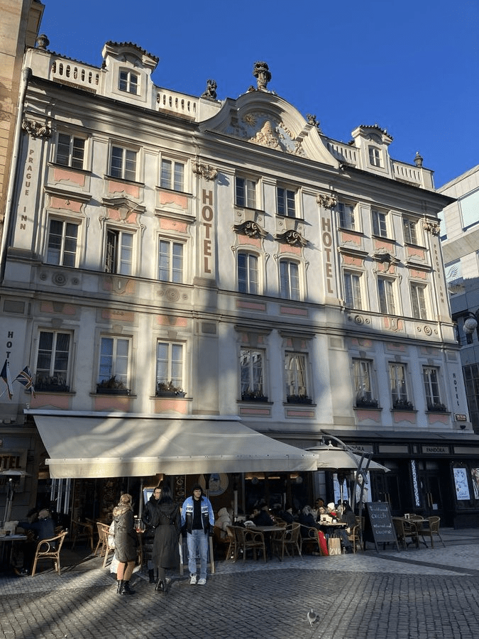
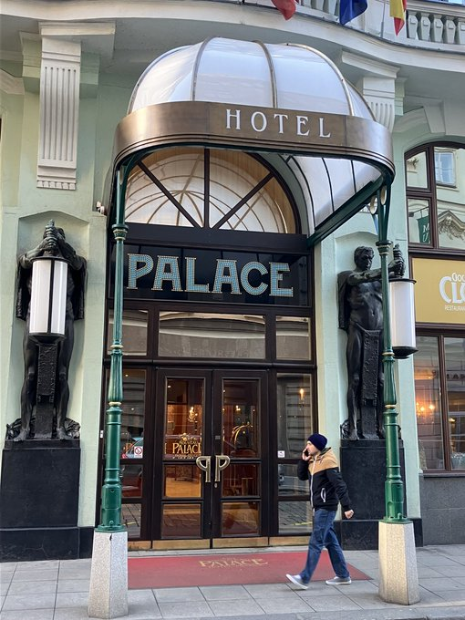
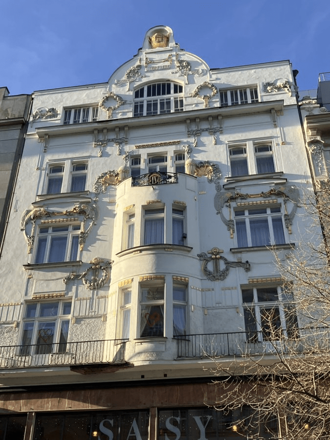
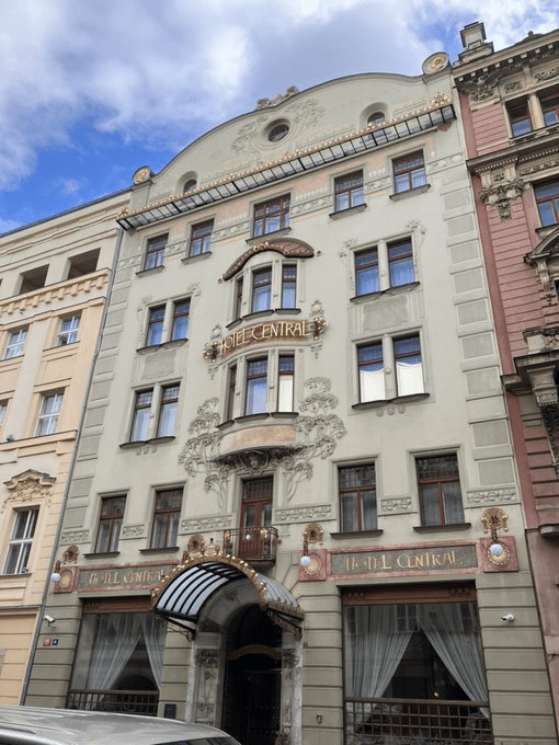
Because, if you look across the road*, you can see the Art Nouveau Palace Hotel, which has been beautifully done up (with hints of kitsch, but I quite like hints of kitsch). So maybe there’s hope for Millesimovský.
* And ignore what I’ll be writing about on day 140
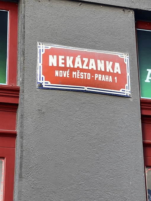
Prague’s New Town was founded by Charles IV in 1348, which I *may* have mentioned 1,348 times to date.
Charles was a busy man, what with also having been crowned King of the Romans in 1346, and also experiencing the death of his first wife (Blanche of Valois) in 1348 when she was just 32, and still needing an heir.
Therefore, Charles was away a lot. When he came back from one trip, he supposedly found that a street had been built in his absence and without his consent.
Kázat means ‘to preach’ or to ‘proclaim’. Charles hadn’t proclaimed that this street should’ve been built. And he (allegedly) said that, for this reason, the street should be called ’Nekázanka’ forever more.
Which, given it’s been almost 800 years, has kind of stuck.
On the other hand, there is nothing unusual about the location or existence of this street, so the entire story is probably a load of rubbish.
The other option – somewhat more likely – can be linked to the fact that nekázeň means a ‘lack of discipline’, i.e. the street was known for Czechs Behaving Badly (it’s not particularly dingy, but one of its neighbours – coming up in a few days – certainly still is).
What Nekázanka is definitely known for now is its skyways, which were designed by architect Osvald Polívka in 1912.
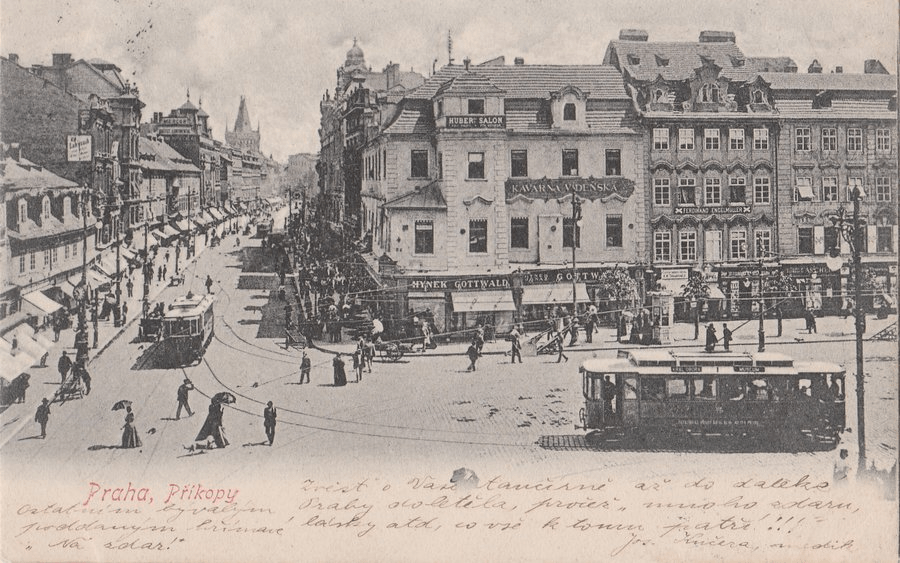
A příkop is a ‘ditch’ or a ‘moat’. Way back in the 1230s, work was underway to create the walls of the Old Town, and, during the process, a moat was excavated here.
The moat wouldn’t be filled in until 1760, when the street was created.
(Stop press: it seems the Starých was added in 1781 to distinguish between the two, and that, while the New Avenues had linden trees, the Old Avenues were all about the chestnuts)
From 1830 to 1870, the street was called Kolowratská třída, after Count František Antonín Kolovrat (1778-1861), Burgrave of Prague, Prime Minister of Austria and member of a family that owned a lot of properties that have come up in these threads. Including number 17 here.
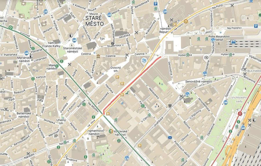
Na Příkopě is the 18th most-expensive shopping street in the world, or it was in 2019. So it may not surprise you that there’s a lot of fine buildings on it. Let’s go for a walk.
Next door, the Haas Carpet House, built between 1869 and 1871, was Prague’s first modern department store.
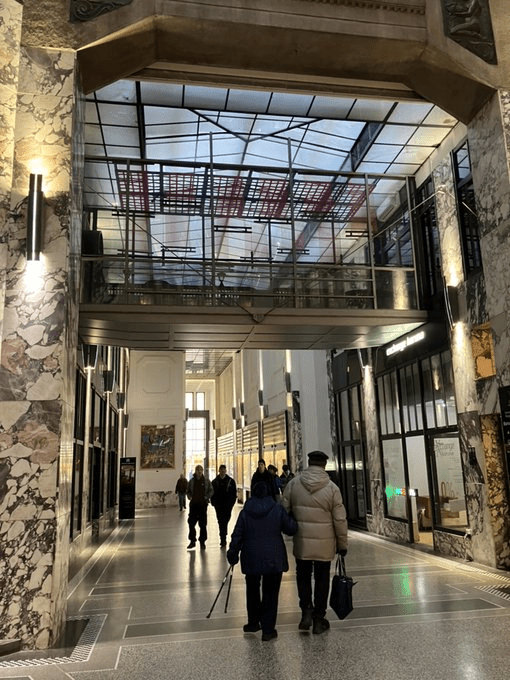
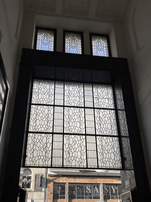
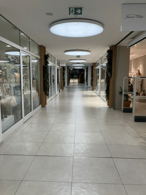
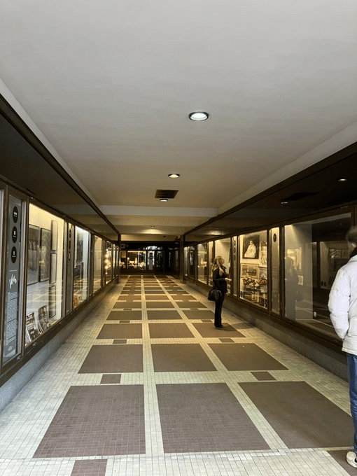
And next to *that* is an entrance to the part of Koruna that is one of Prague’s shopping arcades (and not the only one in this thread). You might not go shopping in these, but they certainly make for good photos.
The late Baroque Sylva-Taroucca Palace used to host many things, including one of the very first places I ever went in Prague – the Museum of Communism.
It’s under major reconstruction and is meant to open as a completely new public space in 2026.
Next door is U černé růže (Black Rose), originally founded by a group of Jan Hus-supporting German refugees. The current building dates from 1847.
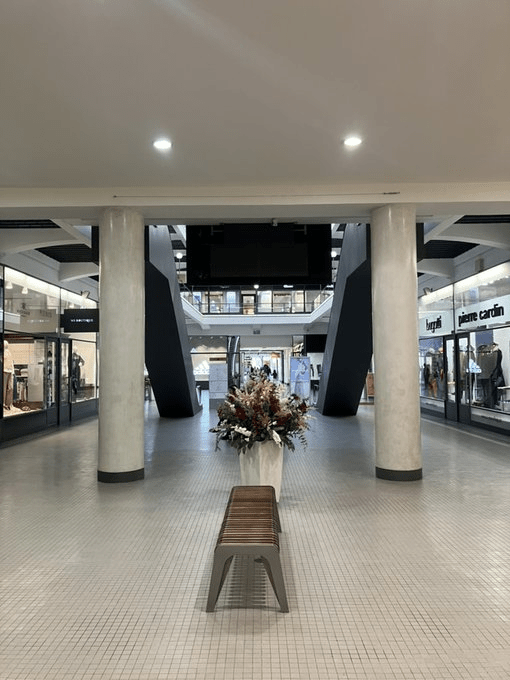
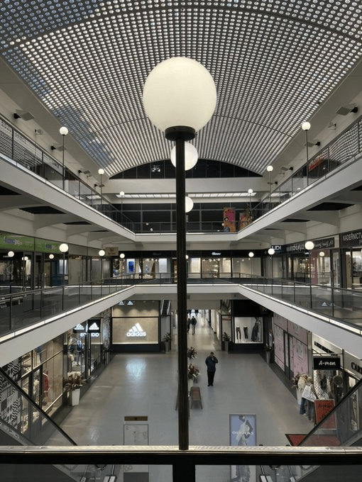
And it has a shopping arcade inside, built in 1932, which I’m somehow quite mesmerised by – it’s old-looking but new-looking, in the centre of town but empty, and with an array of Asian restaurants. I could’ve stood here and taken photos all day.
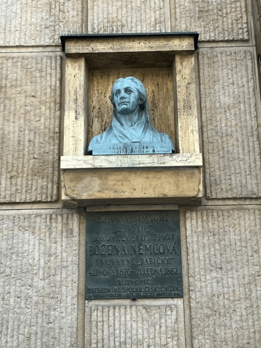
Next door’s Bankovní palác stands on the spot of the house in which Božena Němcová died in 1862.
The church on the corner will be discussed a bit/lot more on day 139.
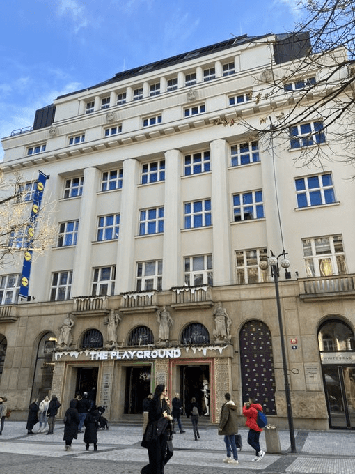
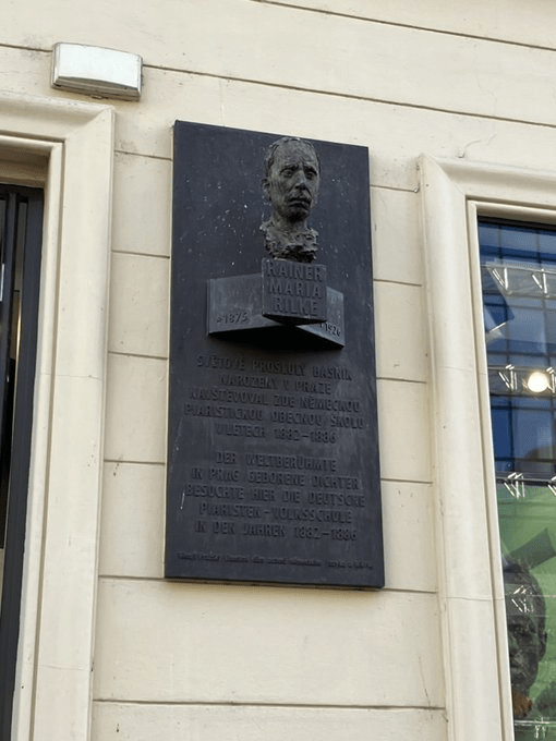
Whereas number 16, the former Piarist Gymnasium (built 1760-5) had pupils including Rainer Maria Rilke.
Number 18, Second Palace of the State Bank (1909-11) has some excellent mosaic action going on; the First Palace is just next door, at number 20.
Slovanský dům might be the ‘Slavic House’ now, but it was once the Deutsche Casino, a major cultural centre for the city’s German-speaking population from 1875 to 1945. It has a well-known cinema, a shopping arcade, and a nice little courtyard.
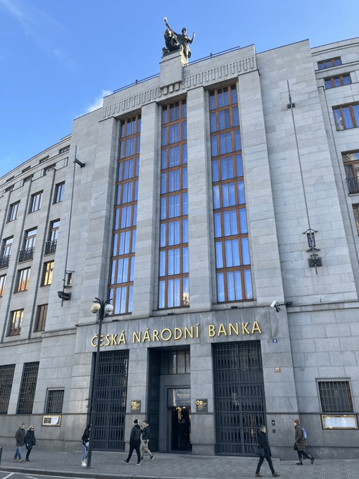
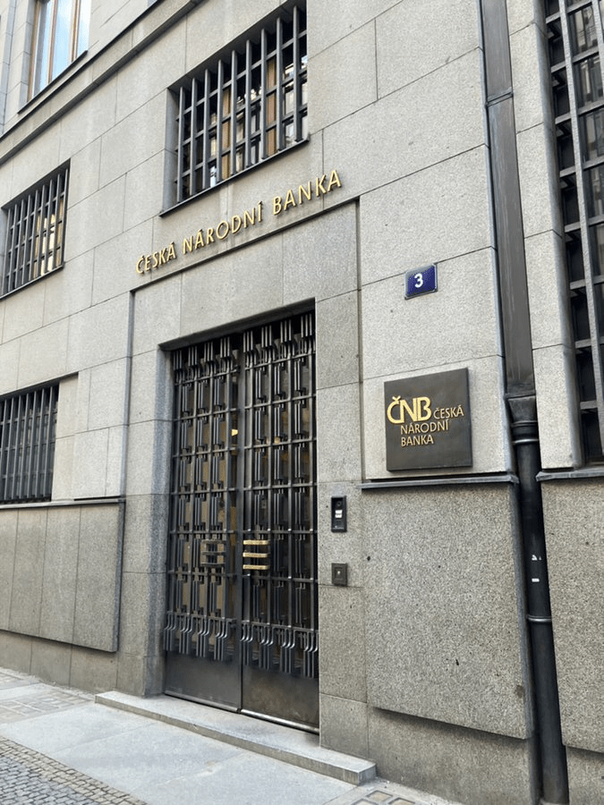
Reach the end of the street, and you’re at the Czech National Bank headquarters, built between 1935 and 1942. The shopping passage here is called ‘Pasáž českého designu’, and is, expectedly, quite stylish.
Crossing the road – I told you this one would take some time – we have the headquarters of the Komerční banka, formerly the Café Français, frequented by František Palacký and Ferenc Liszt, and also once the Central Committee of the Communist Party’s home (1945-60).
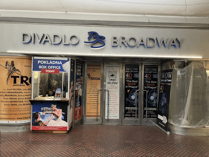
Palác Broadway (1936-8) used to host the eponymous cinema – renamed Viktoria by the Nazis, and Sevastopol by the Communists. Reverting to its original name, it closed in 1998 and there’s a theatre here instead now.
Palác Myslbek is much newer – it was built in 1996.
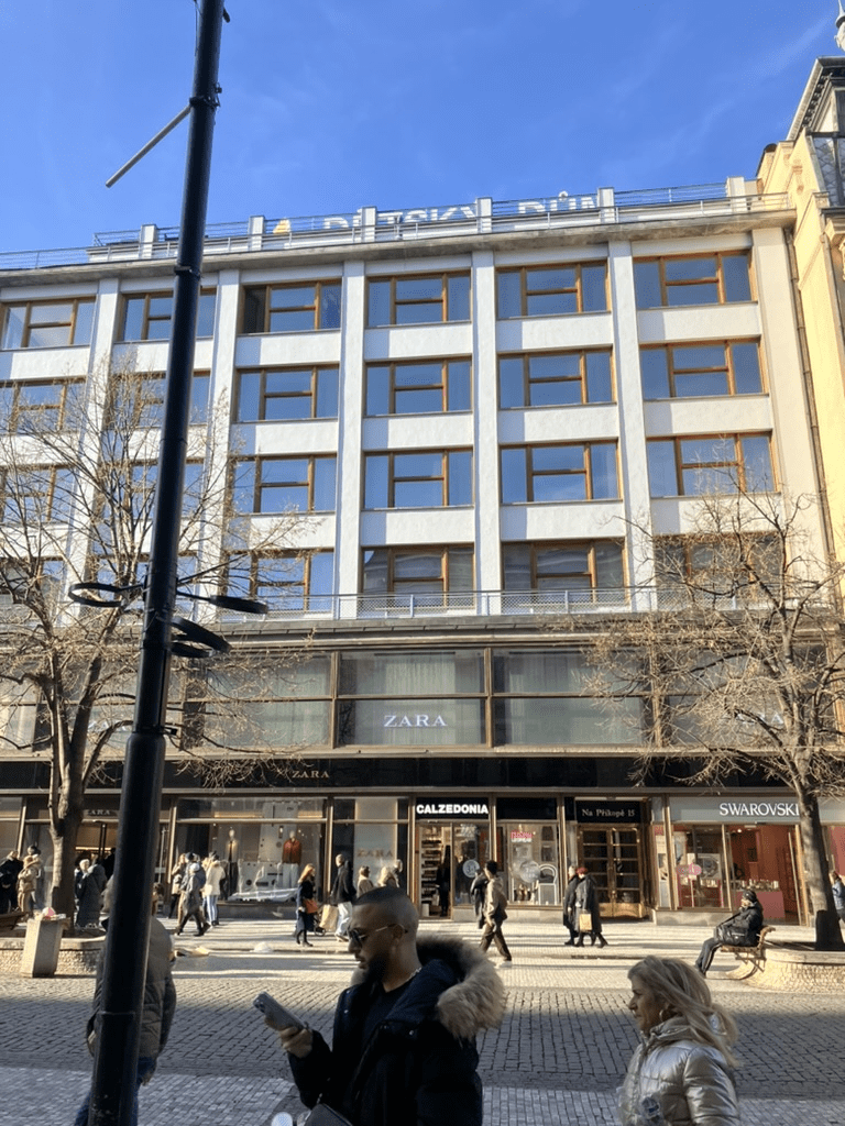
While the Dětský dům (1925-9) – Children’s House – still maintains its original name despite no longer specialising in goods for children. Unless your kids *really* like Zara.
And number 7 – U Dörflerů – gets a pic because it’s a pleasing contrast to the more modern buildings on this side of the street.
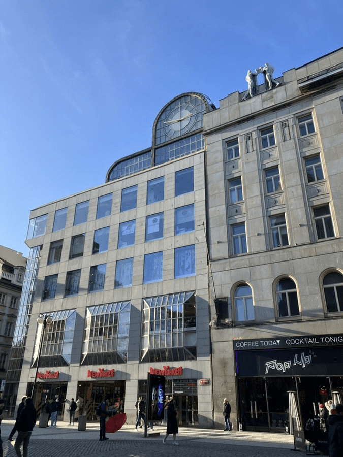
And then we end with Dům Na Můstku, built between 1976 and 1983. It was built for the General Direction of ČKD, the now defunct (since 2000) tram company, most famous for the Tatra T3, still the world’s most widely-used make.
This spot looked rather different once (this building was destroyed in 1901), as did the corner with Václavák.
Finally, I’m not one for ending threads on a downer, but I went home just after taking all these pics and the first thing that I saw made me a bit sad.
Dlažba means ‘pavement’, ‘cobbles(tones)’ or ‘paving’, whereas something that is dlážděný is ‘paved’.
Paving didn’t happen anywhere in Prague at all until 1329, and, when the New Town was founded just under twenty years later, was still the exception rather than the rule.
As well as looking quite nice, cobblestone paving drains water and doesn’t get muddy when it rains. This means that roads can be used all year round.
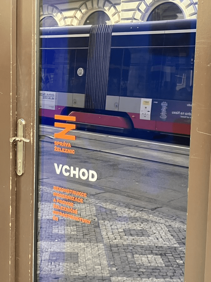
While the other side of the street includes Správa železnic (the Railway Administration), Czechia’s sixth-biggest employer, and one of its most distinctive logos, at numbers 5 and 7.
(Tram part of reflection, not part of logo)
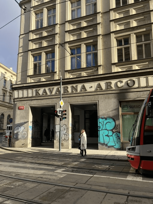
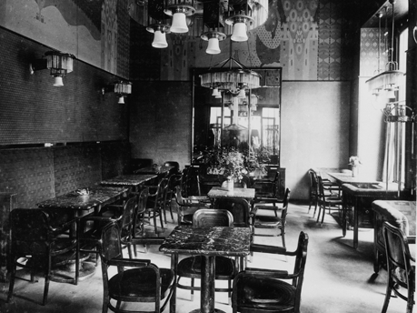
Finally, Cafe Arco was opened in 1907, and used to be *the* meeting place for Prague’s German-speaking intellectuals. Those days are long gone and it’s now a canteen used by the Ministry of the Interior, and open for a grand total of 12.5 hours per week according to Google.
In the pre-New Town was founded, this street was called Horská, because it led to Kutná Hora. It then became known as Na Dlážděném from 1348, and if I explain that now, I’ll ruin tomorrow’s post.
In 1355, a church was built, and dedicated to St Ambrose, Archbishop of Milan from 374 to 397, and now its patron saint. This led to the street’s alternative name, Svatoambrožská.
In 1629, the church was purchased by the Irish Franciscan Order – who were also known as hyberni in Czech, because Hibernia was the Latin word for Ireland.
It seems that the Celtic term *Īweriū got translated into Greek as Iouerníā, and then made its way into Latin – it’s also the source of ‘Éire’, which is the Irish word for Ireland (see also: Raidió Teilifís Éireann).
Anyway, the church was given a Baroque makeover between 1652 and 1659; it was abolished as part of Joseph II’s reforms in 1784, and deconsecrated in 1806.
However, it was destroyed rather than repurposed – its successor, Dům U Hybernů, has been a musical theatre since 2006. It has quite a varied programme: https://www.hybernia.eu/
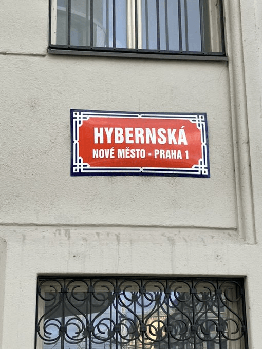
The side of Hybernská that is near Florenc is one of the least aesthetically pleasing parts of Prague 1, but the section nearer to Náměstí republiky is more interesting.
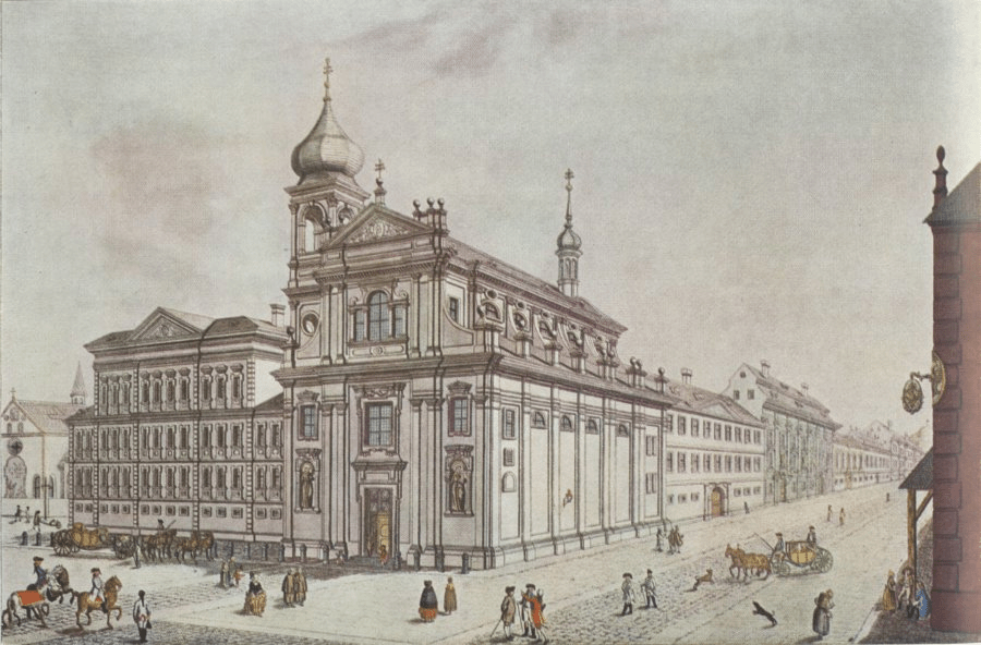
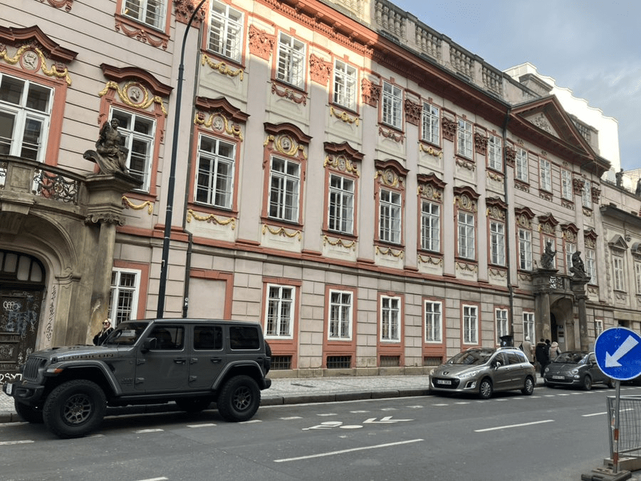
The Swéerts-Spork Palace was, in 1701, the first permanent theatre in Prague. Following reconstruction in 1790, it now has two quite distinct parts – and two separate addresses (3 and 5). Here’s number 3, used by Charles University.
The university and the City of Prague have also collaborated on Hybernská Campus, at number 4, founded in 2021. It’s an event space which intends to ‘connect the public with the university’s activities’.
At number 7, the People’s House (Lidový dům) is the headquarters of SOCDEM, formerly the ČSSD (Social Democrats). Twelve years as the lead partner in government coalitions, three years as a junior partner, and currently not a single seat in parliament.
They also owned the Lanna Palace at number 11 until they were short of money and therefore sold it.
While Věžník Palace, at number 12, was used by the Institute of National Health until 1996, but is now an upmarket hotel. Next door at number 10 is, well, another upmarket hotel.
For the language fans, in Irish, Prág is the capital of An tSeic, which is made up of An Bhoihéim, An Mhoráiv and An tSiléis. Until 31 Nollaig 1992, it was the capital of An tSeicslóvaic (the capital of An tSlóvaic is An Bhratasláiv).
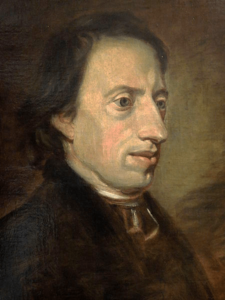
Bernard Bolzano was born in Prague in 1781. His father was an Italian-born arts dealer, while his mother came from a German-speaking family which had arrived in Prague from Austria around 1700.
Graduating from the Piarist gymnasium in 1796, he then studied mathematics and philosophy, switching to theology in 1800.
He was ordained as a priest in 1805, and graduated from Charles University as a doctor of philosophy ten days later. Later that year, he would become professor of philosophy of religion at the University. He also started preaching there, becoming popular in this role.
Before this all starts to sound a bit too much like a nauseating ‘Is there anything I can’t do?!’ LinkedIn profile, two books published by Bolzano in this time were banned the Catholic Church.
Emperor Francis I banned Bolzano from teaching in 1819, on the grounds that he was too liberal for the Viennese authorities.
Bolzano lived in seclusion after this, devoting himself to scientific research and also recuperating from various illnesses; a trial conducted by the church against him would drag on until 1825.
Bolzano moved back to Prague in 1842 (specifically to Celetná), and worked as a secretary for the Royal Czech Society of Sciences.
He died of tuberculosis in 1848 and is buried at Olšany Cemetery.
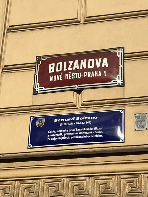
Bolzanova, to the left of the train station, is pretty short, with only one block of houses – but the most distinctive structure in the street isn’t a house.
Is it being used now? I don’t think it is but am happy to stand corrected. In any case, it used to be an exchange office not so long ago (like Prague doesn’t have enough of those), and also had an unauthorised ATM added to it (because ditto).
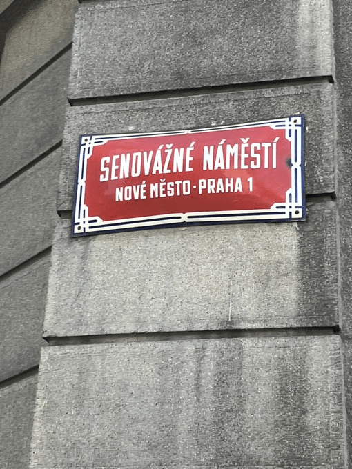
Your regular reminder that a ‘náměstí’ is a square, but doesn’t necessarily have to be square in shape.
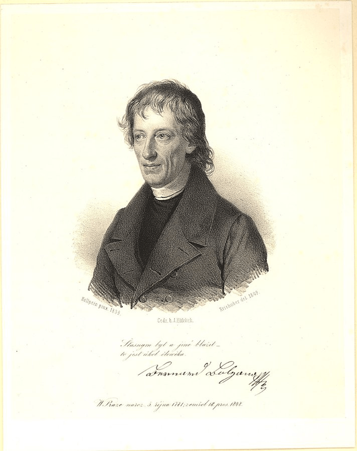
Let’s start with a language lesson: seno is ‘hay’, while váha means both ‘weight’ and ‘weighing machine’. So, a senováha is a hay scale, and this is Hay Scale Square.
In 1360, Charles IV declared that it was permitted to sell hay, fodder and oats in this location, and a weighing machine was placed there. The market was originally called ‘Senný trh’ (Hay Market), before getting its current name in the 1400s.
In 1927, it then became Soukupovo náměstí, after František Soukup (1871-1940), a social-democratic politician, and Czechoslovakia’s first Minister of Justice.
During the Nazi occupation, it was Senovážné náměstí again, before reverting to Soukupovo until 1951, at which point it became náměstí Maxima Gorkého, after the Russian writer and socialist.
Clearly somebody was napping in the early 90s, because there was a gap of over three years between the Velvet Revolution and the square getting its current name back in January 1993.
Things on Senovážné include the Crop Exchange (logically enough), used as the headquarters of Czechoslovak Television during communism, and by the Czech National Bank since 1994.
Across the road, at number 1, is the Probation and Mediation Service (PMS), which is supervised by the Ministry of Justice and, as you might have guessed from the name, performs probation and mediation in matters pending in criminal proceedings.
A bit further down, number 8 is the Embassy of the Philippines.
The statues/fountain in the centre of the square date from 2002, and are known as the Czech Musicians (Čeští muzikanti), designed by Anna Chromy (1940-1921) and Jan Wagner (1941-2005).
The fountain depicts musicians as rivers: the mandolin-player is the Ganges, the flautist is the Amazon, the violinist is the Danube, and the horn-player is the Mississippi.
A fifth sculpture, at a distance from the others, represents the Nile.
The Mortgage Bank of the Kingdom of Bohemia moved into number 13 in 1890. It’s now the Carlo IV hotel, and, if you want a room there tonight, it’ll cost you about €120, i.e. that the person who once told me it’s the most expensive hotel in Prague might have been lying.
Finally, if you dream about a senováha tonight, this is apparently a sign that you should follow your goal strictly, says someone on the internet: https://babiccinsnar.s1.pexow.com/senovaha.html
‘Jindřich’ is Henry, and the two don’t seem so different once you realise that one of the German versions of ‘Henry’ is ‘Heinrich’.
And one famous German Henry was Henry II (973-1024), Holy Roman Emperor, also known as Saint Henry the Exuberant.
He essentially incorporated Bohemia into the Holy Roman Empire, and had a profound fondness for fighting for Poland.
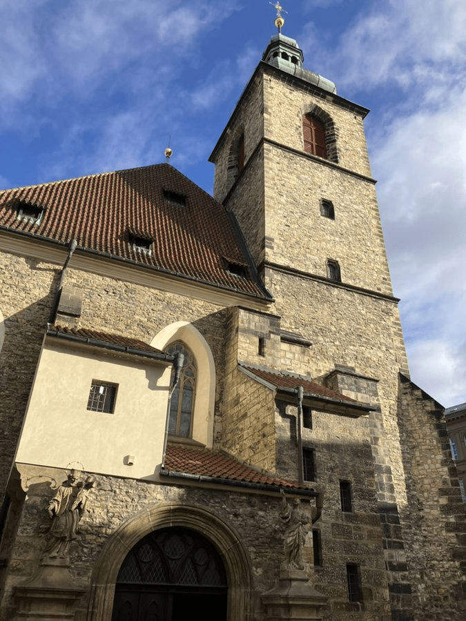
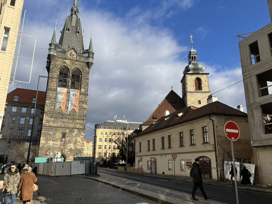
Saints get churches dedicated to them – such as the Church of St. Henry and St. Cunigunde / Kostel svatého Jindřicha a svaté Kunhuty, consecrated in 1351, a few years after the New Town was founded.
(Cunigunde of Luxembourg (975-1040) was Henry’s wife)
The Hussites were in control of the church for about two hundred years from the early 1400s onwards. In the 1470s, they built a new bell tower.
Those of you who pass through central Prague on a regular basis will recognise it.
What you see these days of the church these days is largely the result of a major renovation in 1879; the tower, meanwhile, was done up in the 1970s, and gained new floors, a lift and a viewpoint.
It’s also got a ‘romantic unique’ restaurant, because what doesn’t spell romance like the possibility of a very large bell going off in your ear while you’re eating.
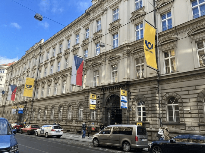
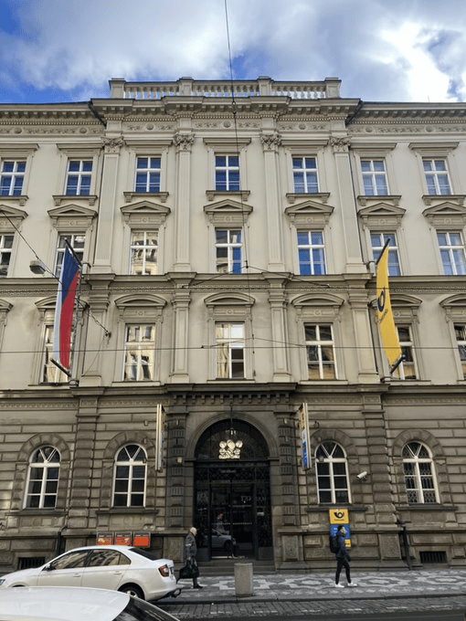
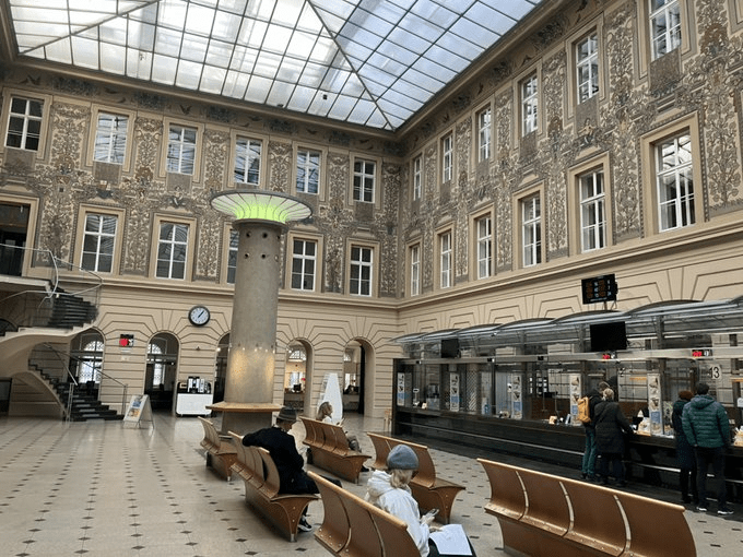
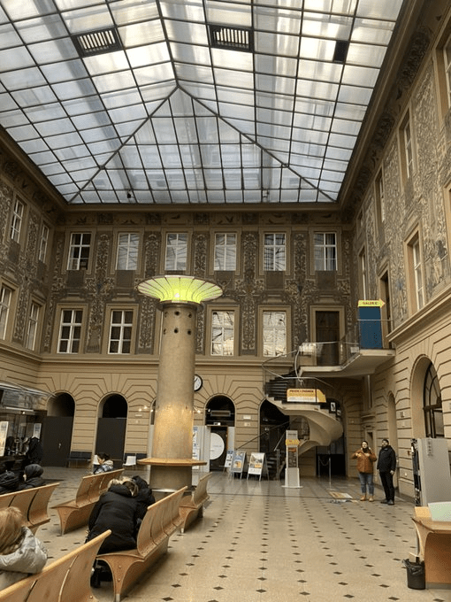
Jindřišská is also home to Prague’s main post office (more main than ever after so many local ones were closed last year). It was built between 1871 and 1874 in Neo-Renaissance style.
I might have gone off on a Twitter rant about the waiting times when I was there on Tuesday evening, but I can’t deny that its interior is stunning.
Meanwhile, the post office that was ten minutes from my flat until last summer remains empty, and I hope the people who worked there have found something new.
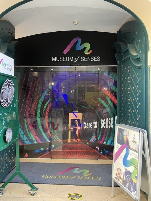
Just down the road, Harrach Palace was built in 1770 but is named after its owner around the 1850s, František Arnošt, Count of Harrach. It contains the Museum of Senses, which I’ve just spent ten minutes trying to come up with a pun about. And failed.
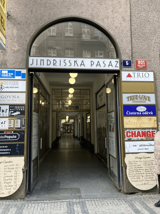
Jindříšská has also given its name to one of the New Town’s multiple shopping arcades.
I would say that Jindřišská is a key thoroughfare on the Prague tram network, but, given the current roadworks near the train station and the amount I’m having to use Bolt lately, that is, for some of us as at 2 February 2024, a lie.
Looks nice though.
Update: Czech Post called off its plans to sell the post office building in May 2024, although one could argue that, as no bids were received, the decision was really made for them.
Back in the early days of the New Town, this street was called Sedmihrady, which is Czech for Transylvania (see also: the German ‘Siebenbürgen’), and if you want to know a little bit about Czechs in Romania, take a look at https://whatsinapraguestreetname.com/2024/06/30/prague-2-day-52-rumunska/.
However, it’s more likely that the street was named after a house called U sedmi hradů (At the Seven Castles), which was reputedly owned by George of Poděbrady’s cook.
Around the turn of the 19th and 20th centuries, Prague underwent asanace, which can be translated as ‘rehabilitation’ or ‘renewal’, but, in reality, also involved the destruction of a lot of historic buildings.
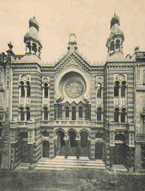
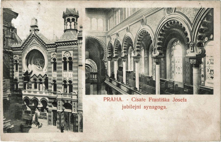
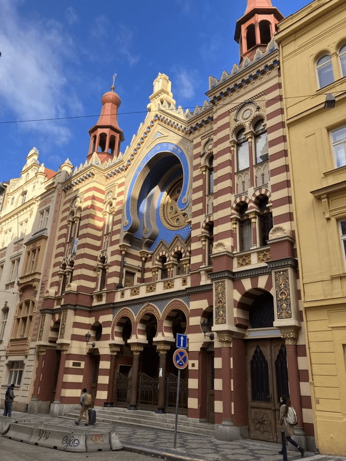
Josefov, formerly Prague’s Jewish ghetto, bore the brunt of this. Three important synagogues were destroyed, and so, in 1899, the Israelite Synagogue Association bought some land on this street in order to build a new one.
In 1903, a proposal for its design was submitted by Wilhelm Stiassny – who had also designed several synagogues across the Austro-Hungarian Empire – and was approved.
Building started in 1905, carried out by the Czech Alois Richter, and was completed in the following year. It’s also known as the Jubilee Synagogue (Jubilejní synagoga), as it was built to honour Franz Joseph’s Silver Jubilee.
For those who are rightly pointing out that Silver = 50, and 1906 – 1848 = not 50, the original plan to build the synagogue had been hatched in 1898.
The synagogue was closed down by the Nazis in 1941, and used as storage space for confiscated Jewish property – which is presumably why it wasn’t destroyed.
Also of interest in the street is the functionalist Edison Transformation Station, built between 1926 and 1930. Part of Prague’s electricity network until the 1990s, it now hosts an excellent cinema: https://edisonfilmhub.cz
In the early days of the New Town, written sources refer to the street as ‘nová ulice faráře svatojindřišského’, or the ‘New Street of the parish priest of St Henry’s’.
This was partly because the street was next to the church on Jindřišská (coming up on day 131), and also partly because the concept of a nice catchy name that would fit onto a nice red and white street sign hadn’t been invented yet.
A půjčovna is a ‘rental shop’. If you live here, you may have seen the words půjčovna aut (rent-a-car) around town.
It can also be used to refer to a ‘pawn shop’ (the more common Czech term for this is zastavárna), where you can get a loan in exchange for some kind of collateral.
While the first pawnshops were created in China about 3,000 years ago, it was in the 13th and 14th centuries that Italian moneylenders, typically from Lombardy, started to operate pawnshops across Western Europe.
This is why, if you go to Poland or Ukraine, you will see lots of ‘lombard’ signs around – that’s the term for ‘pawn shop’ in both languages.
Prague didn’t get a pawnshop until 1747, however, and this was located in the Old Town before moving to this street in 1846, taking over the premises of a short-lived theatre.
Number 4 on the street is a local branch of the Pštrossova Elementary Art School.
While number 10 is on the site of the former pawn shop. It looks like it needs a hug.
‘Růžová’ means two things: firstly, it’s the feminine adjective from růže (rose); secondly, it’s a colour which is prominent in Barbie, a film which there were one or two or three million op-eds about on this site last week.
Before the New Town was founded in the 14th century, the area around here was a village called Chudobice.
Gardens were later made on Chudobice’s territory, and I’m going to assume at least one of them was a rose garden.
(To the person at the back asking if there was ever a Czech cover version of Rose Garden, of course there was)
When the New Town was built, a church – the Church of Saint Henry and Saint Cunigunde, AKA The One On Jindříšská – soon followed, and inherited a garden, although the area would become less and less green as it became more residential.
Rose-related names appear as early as 1418, such as Růžená, or Domy v zahradě růžové (Houses in the rose garden); the current name has been in place since the 1800s.
For vocabulary fans, růžové líce are rosy cheeks, křiklavě růžový is shocking pink, dívat se na svět růžovými brýlemi is looking at the world through rose-tinted spectacles, and růžové víno is ‘rosé wine’.
Here’s a quite ‘so this happened’ 2000 Czech cover version of Where the Wild Roses Grow, originally by Nick Cave and the Bad Seeds and Kylie Minogue:


#/media/Soubor:M%C5%AFstek_oblouky.jpg)
#/media/File:Ulice_V_Cipu,_vpravo_budova_hotelu_Art_Nouveau_Palace.jpg)