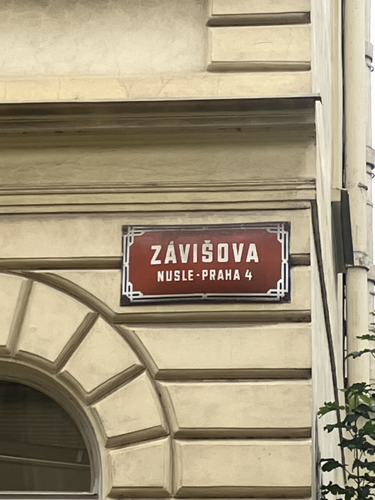
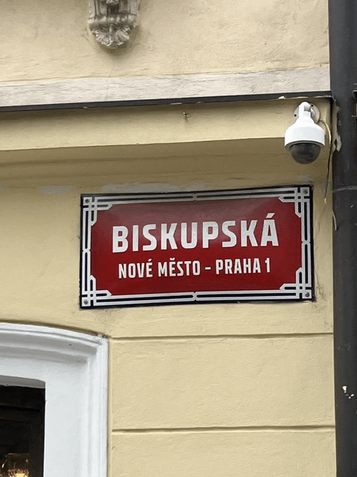
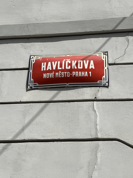
At the date of writing, this street was still under construction, which means this was the best photo I could get.
Jan Josef z Vrtby was born in 1669, part of the noble Vrtba family. Already in an advantageous social position, his prestige increased yet further in 1690 when he married Susanne Antonia Heussenstamm, a countess (side note: they were already related enough for permission from the Pope to be needed before the wedding could go ahead).
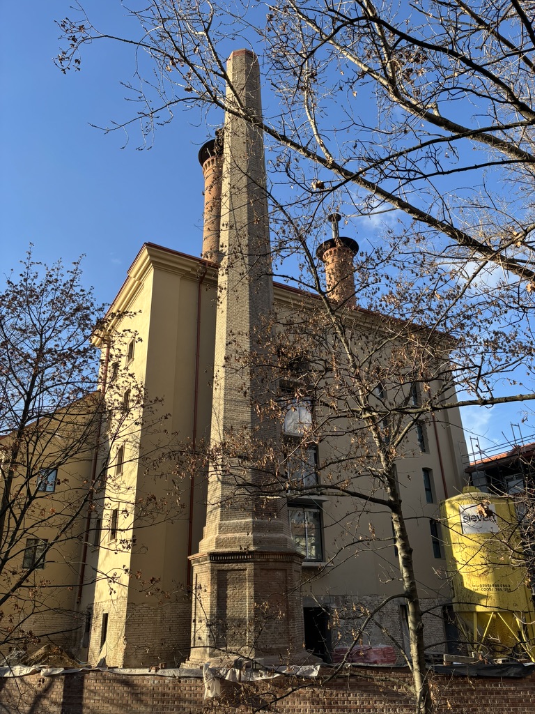
Having inherited part of the village of Dolní Nusle, he purchased the remaining part around this time, and, in 1694, had a brewery built, as well as a one-story château.
Jan Josef also become hugely powerful within Bohemia: in 1712, he was chosen as Supreme Burgrave of Prague Castle – making him the territory’s most important land official and head of the Bohemian Diet. In 1723, he became Treasurer of Bohemia.
After Susanne’s premature death in 1715, Jan Josef never remarried, finding solace by becoming a patron of the arts; among those that he provided financial support to was one Antonio Vivaldi.
He died in 1734.
The château he had constructed in Nusle is no more, but we’ll go into further detail on that in a few days. The brewery, meanwhile, still exists.
Finally purchased from the Vrtba family in 1857 by a local, Antonín Procházka, it was then bought by the Prague Credit Bank in 1897.
Brewing beer until 1963, its buildings are now mainly used to process and cultivate wine. The area around here, dilapidated for some time, is now being converted into a residential district; the listed buildings of the brewery complex are going to be renovated and revitalised.
We’re off! Závišova was built in 1892, which is also approximately when I finished work on What’s In a Prague 1 Street Name.
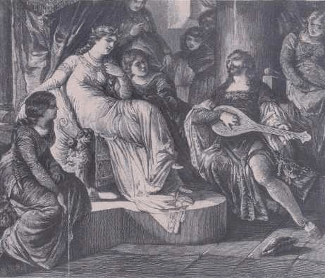
Záviš z Falkenštejna was born around 1250, as a member of the South Bohemian branch of the noble Vítkov family. He was first mentioned in writing in 1262, when King Přemysl Otakar II put him, his father and his brother in charge of a monastery in Austria.
However, it was also around this time that the Vítkovs started to feel threatened by the King, who was building his power in South Bohemia (particularly by founding České Budějovice in 1265).
Things came to a head in 1276, when the Vítkovs – in conjunction with Austrian and Styrian nobles, as well as the Rožmberks, another Czech family – started a rebellion against Přemysl Otakar. Záviš fled to his estate, which was in Habsburg-controlled territory, and was sentenced to death in absentia.
In 1278, Přemysl Otakar would be killed by German, Habsburg-led forces at the Battle on the Marchfeld (Czech: Bitva na Moravském poli), all of which I’m glossing over slightly here because there’s an Otakarova street coming up on day 6.
He was replaced by his son, Václav, who was only six years old, and so his cousin, Otto V, Margrave of Brandenburg-Salzwedel, ruled as regent. Václav, meanwhile, was held captive for a few years. So much for being king.
Záviš decided it was safe to return to Bohemia, but old habits die hard: by 1279, he was in conflict with the Brandenburgs, and burned down Budějovice.
In 1280, he went to Hradec nad Moravicí, now in Opava District, where Otakar’s widow, Kunigunde (Kunhata) was residing. They embarked on a love affair, and moved to Moravia in 1281, having a son, Ješek, around the same time.
In 1283, Václav – now 12 – was released from captivity. Kunhata and her new family returned to Prague, where an unusually peaceful coup took place. One result of this would be that Záviš basically became the chief administrator of the country.
Sadly, Kunhata – to whom Záviš had got married at some point – died in 1285; initially, his position within the court was unaffected.
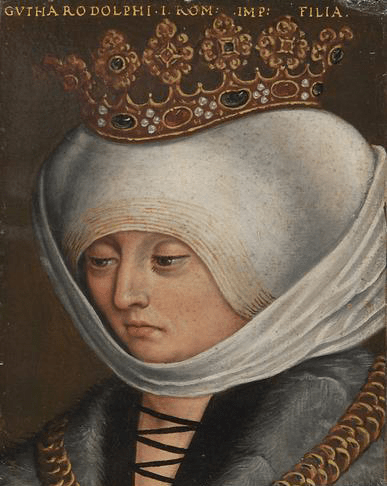
However, in 1287, Václav’s wife, Judith of Habsburg (Czech: Guta Habsburská) arrived in Bohemia, and made it quite clear that she and the rest of the Habsburgs were not fans of Záviš.
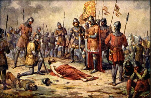
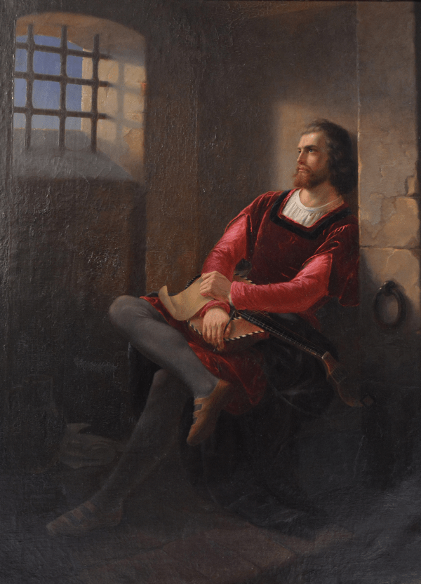
Záviš thought it might help his position if he got married again – in 1288, he married Elizabeth of Hungary (Czech: Alžběta Kumánka). They had a son later that year, and, in early 1289, Záviš made the fatal mistake of inviting Václav to the baptism. Záviš was duly arrested and accused of treason and attempted murder.
Held in captivity until the summer of 1290, Záviš was found guilty and executed on 4 July at Hluboká nad Vltavou.
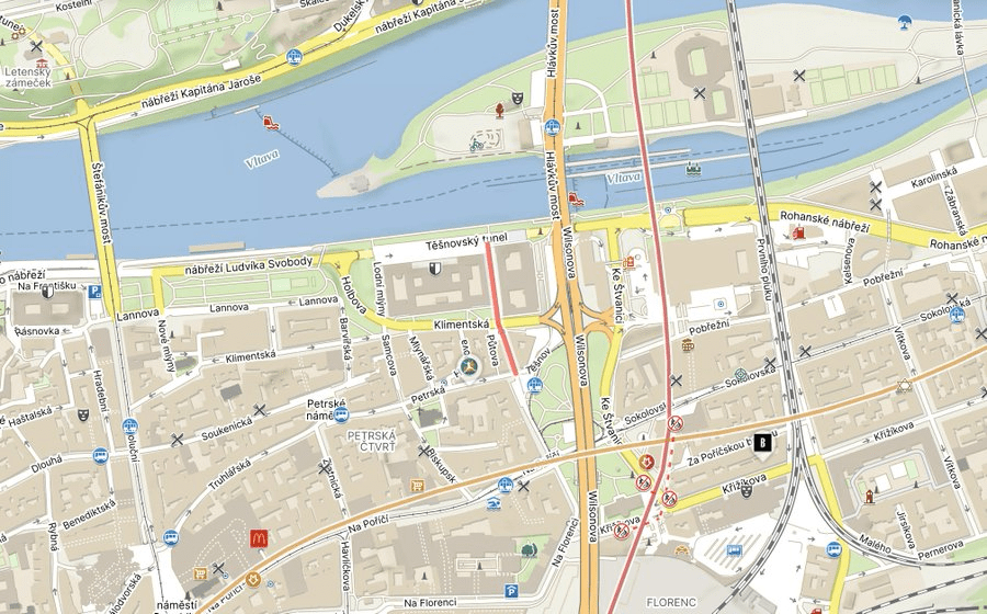
Given its location, and the fact that it came into being during the presidency of Gustáv Husák, it’s colloquially known as Husákovo ticho (Husák’s Silence).
An unconfirmed story has it that the tunnel was built so that the sound of passing cars wouldn’t disturb the Communists’ meetings. This seems unlikely, but I can confirm that the cars are still pretty loud.
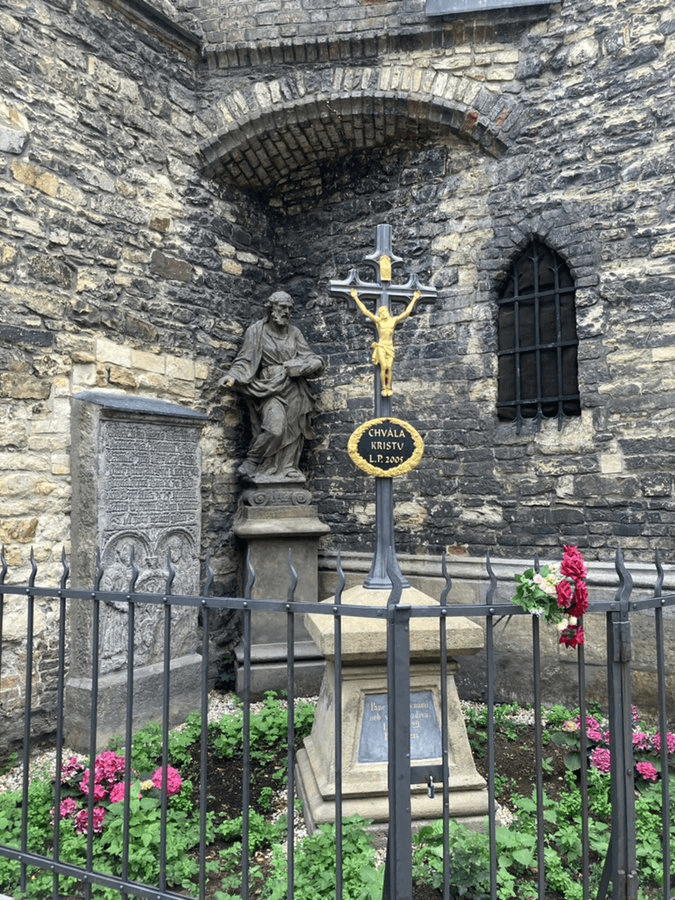
While we’re in the area, this nearby statue, created by Jiří Plieštik and unveiled in 2004, deserves a bit of attention.
Its location near the Ministry of Agriculture is anything but coincidental – it commemorates the people who were screwed over by collectivisation (i.e. the abolition of private ownership of agricultural land), which mainly happened in the 1950s.
95% of farms in Czechoslovakia were collectivised – with the process being more thorough here than in Slovakia – and nobody could own more than 50 hectares of land. Many left agriculture – and the countryside – altogether.
Hence the depiction of sheaves of corn surrounded by barbed wire.
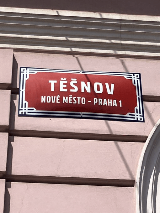
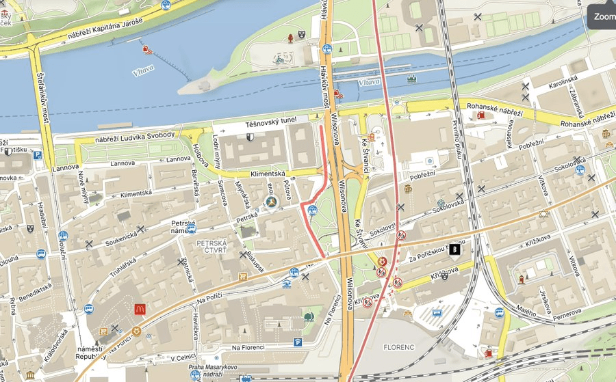
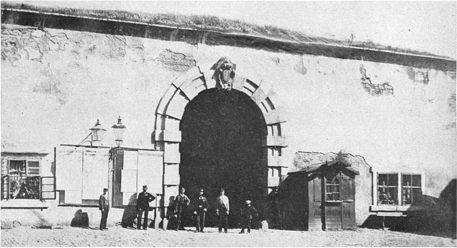
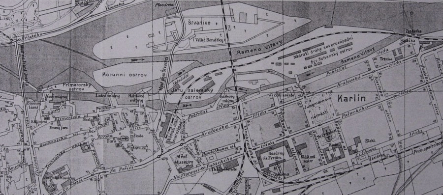
The first written mention of Těšnov, a settlement just outside the New Town walls, and only consisting of a few guardhouses, dates from 1437.
(Photo of the Pořící gate before its destruction in 1875)
You might remember that Pořící – immediately to the west – was largely inhabited by Germans; Těšnov is believed to be a corruption of Deutschenhof, or ‘German Court’.
Těšnov even had its own magistrate, but, not long after it was first mentioned, the settlement became deserted and wouldn’t be mentioned again for about four hundred years.
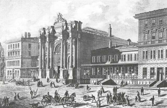
In the 1870s, Prague gained a trio of railway stations. You probably know the main one, and what is now Masarykovo, but the terminus of the Austrian Northwestern Railway was located where Těšnov had once been.
After using a temporary building on Rohanský ostrov for a couple of years, the train station was unveiled in 1875. It was called Praha – severozápadní nádraží / Prague – North-West Station.
It was a spectacular Neo-Renaissance complex (by the architect Carl Schlimp), with a triumphal arch, four Corinthian columns and an allegorical sculpture of Austria.
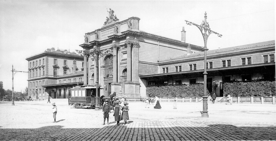
Houses began to be built around the station, and, in 1894, the new street was named Těšnov.
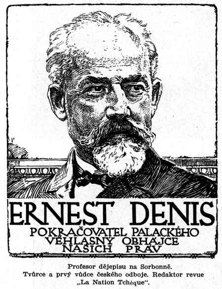
In 1919, the station was renamed Denison, after Ernest Denis (1849-1921), a French historian and Slavophile who had created the Comité national d’études, an organisation advocating for Czechoslovak independence.
In 1953, the station was renamed Praha-Těšnov. However, as the years went by, the authorities decided roads were more important than tracks.
This led to the decision to create a highway running through the centre of the city, but there was a problem with this plan: one of the corners of the train station stood where the road was meant to be.
There were discussions about turning the station into a museum, but many in the Communist Party wanted it to be demolished in the name of progress.
The last train left the station on 1 July 1972.
Efforts to save the building came to nothing, and it was blown up in 1985. The silver lining – a very, very, very thin line – is that many of its contents were transferred to the depositories of the Museum of the Capital City of Prague.
Těšnov (the street) was almost certainly a heck of a lot nicer before all this reconstruction happened too. Nowadays, it definitely has parts you’d avoid at night, and maybe also during the day.
In ‘things that weren’t demolished’ news, Těšnov is where to go if you want to see the facade of the Ministry of Agriculture (or, more realistically, these days, protest outside it).
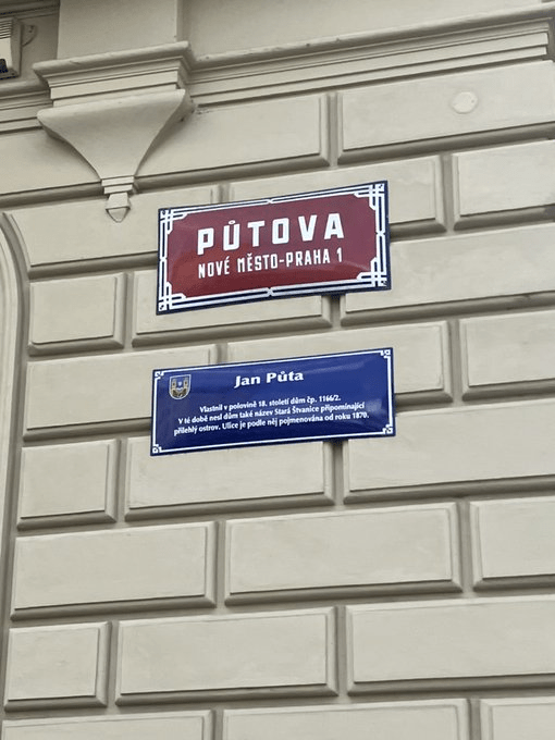
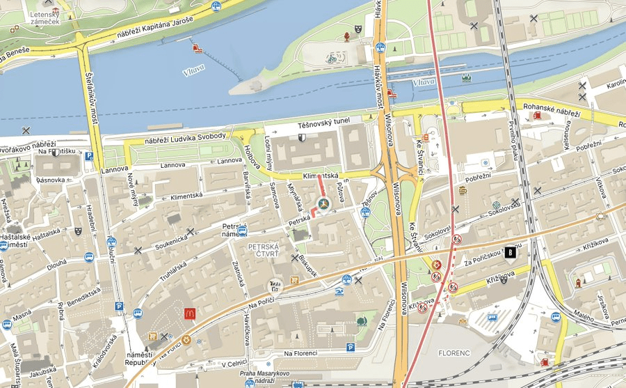
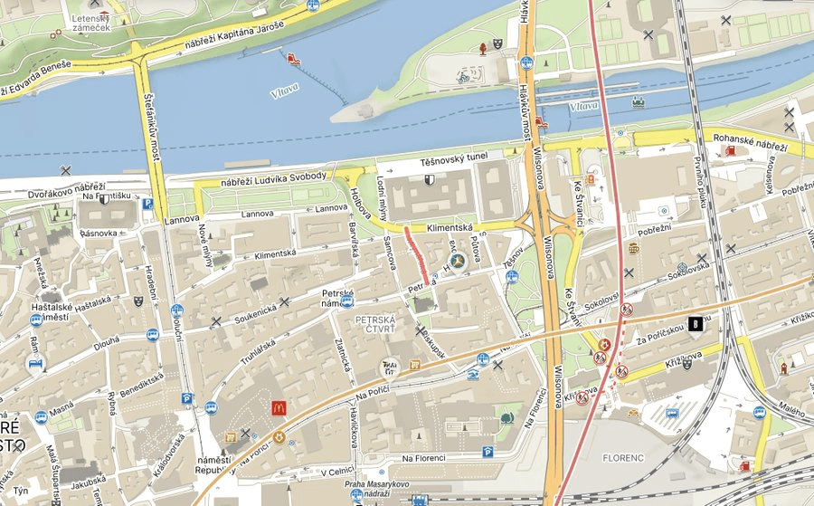
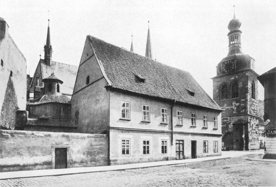
In the mid-1400s, there was a house on the street called Stará Štvanice, named after Štvanice, an island just to the north of here (see the map).
It belongs to Prague 7, hence only being mentioned in passing to date.
In the mid-19th century, the house was purchased by a Mr Jan Půta, hence Půtova (Spanish and French speakers may have been hoping for something a bit more salacious. Lo siento).
The street is not the widest, and only has three addresses. Nice colours though (the former Casa Půta is the beige one at number 2).
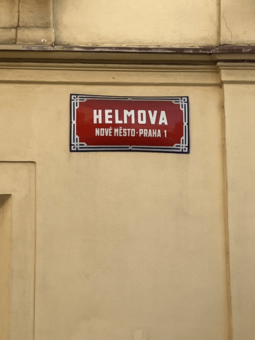
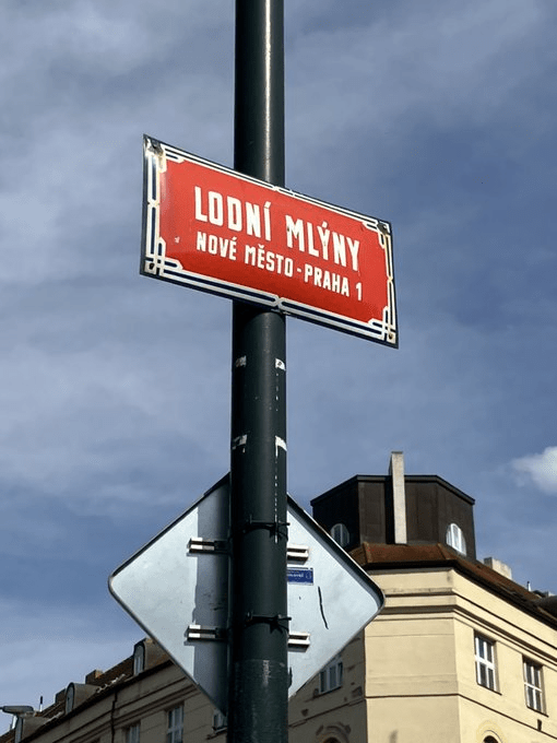
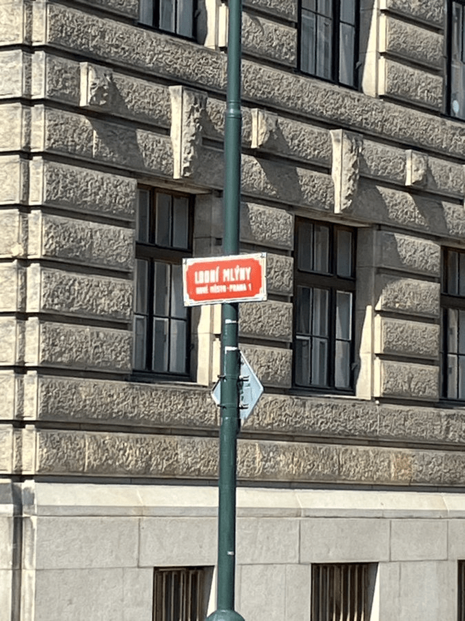
Some of the mills which used to be here – and are taking up quite a large chunk of recent threads – were owned by the Helm family, one of the richest in the New Town.
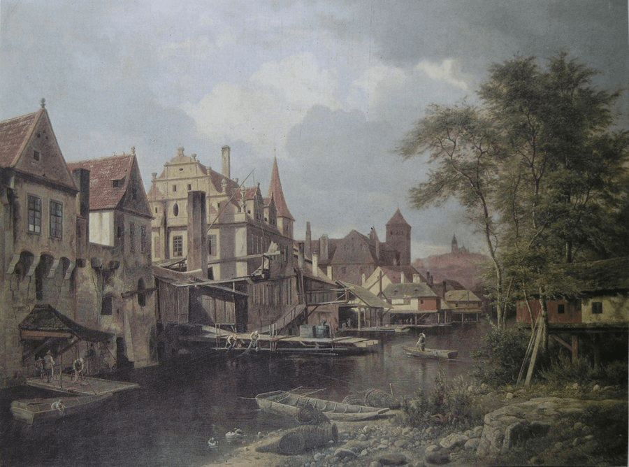
Their name is first mentioned in connection with the mills in 1398; here are the mills in 1853, as painted by Bedřich Havránek.
There were both upper and lower ship mills around here, and the street was named after the latter in the 1700s, i.e. it was known as Dolní lodní mlyny, although the current name has stuck since the 19th century.
It’s also another case of a street where you have to do a trade-off between dealing with traffic and getting a decent photo of the street sign (here’s attempt number 1).
We’ve only got five posts to go now, and… there will be yet another mill-related one in there.
At the start of the 20th century, the Vltava still flowed here before its banks were regularised.
In the 1920s, the area was greenery (and, say what you want about that first picture, but it’s definitely green); in the 1930s, a sports ground for university students appeared.
Then, in 1955-6, a summer cafe was established where the street is now. It was called Pavilonek, and belonged to the Central Committee of the Communist Party – who had their premises in today’s Ministry of Transport.
A bunker had been built under said building in the 1930s; in 1962, it was extended, and the new parts were under Pavilonek, which was also ‘lucky’ enough to have a statue of Klement Gottwald next to it.
The bunker would later be known as Husák’s Bunker, despite Husák not being First Secretary of the Communist Party until 1969, or President of Czechoslovakia until 1975.
The cafe was knocked down in 1977 due to construction of a nearby tunnel (coming up in a few days); the last remaining building on the street survived until 1981.
There’s been talk of converting it into a museum, although things have gone rather silent on that count since about 2015.
Helping to explain the substandard picture, Holbova features minimal pavements (I’m sure I saw a glimpse of one, but it only lasts a few metres), nowhere to park your car, and no buildings.
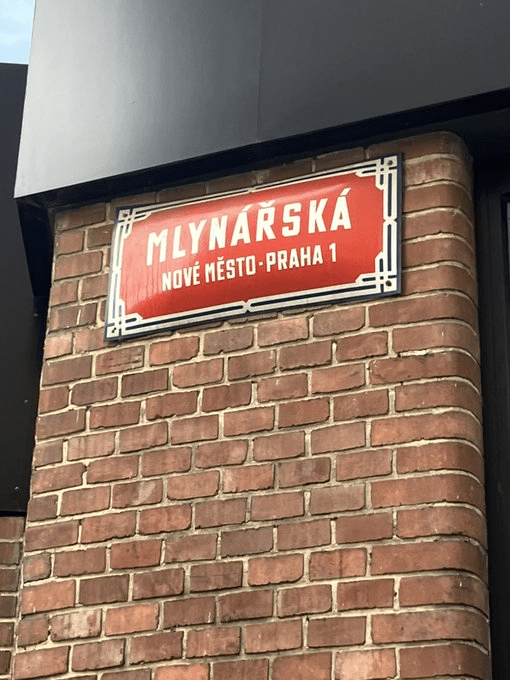
In the early 1400s, this street – along with Mlynářská, which is one of the eight streets we haven’t covered yet – was called Mezi pekaři (Among the bakers), because they had set up shop round here.
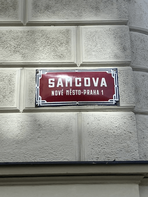
‘Samec’ can be translated as ‘male’ or ‘male animal’ (and, according to Seznam’s dictionary, could also be used to denote someone who is ‘macho’), but nobody seems to think this has led to the street name.
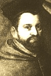
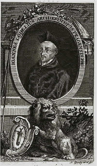
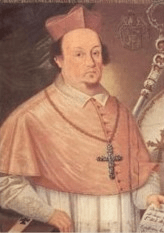
Between 1561 and 1594, the Grand Masters of the order were given the title of Archbishop of Prague, and the area around the church became known as Biskupský dvůr (Bishop’s Court).
For completists, the first four of these archbishops were Antonín Brus z Mohelnice (1561-80; picture 1), Martin Medek z Mohelnice (1581-90), Zbyněk Berka z Dubé a Lipé (1592-1606; picture 2) and Karel z Lamberka (1607-12).
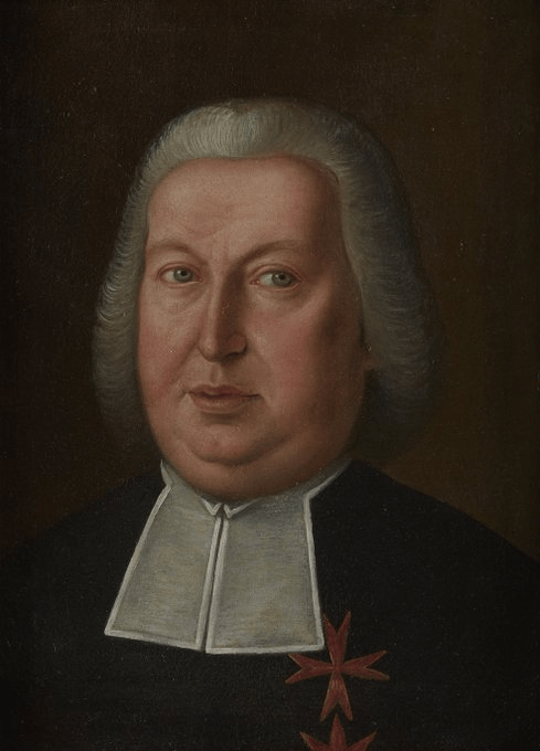
And the next four were Jan Lohelius (1612-22), Arnošt Vojtěch z Harrachu (1623-67), Jan Vilém Libštejnský z Kolovrat (1667-8) and Matouš Ferdinand Sobek z Bílenberka (1668-75).
Followed by Jan Bedřich z Valdštejna (1675-94).
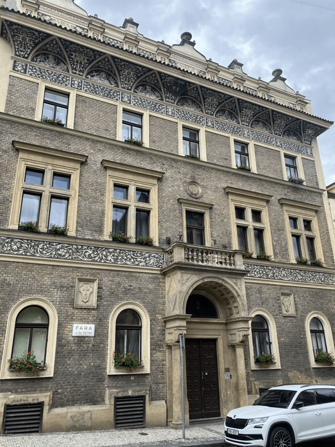
Biskupská also features the church’s Neo-Renaissance parsonage, built in 1893 based on a a design by Konstantin Mráček. The façade – and its sgraffito designs – are the work of Antonín Wiehl.
For those keeping count, we have ten streets to go before we’re done.
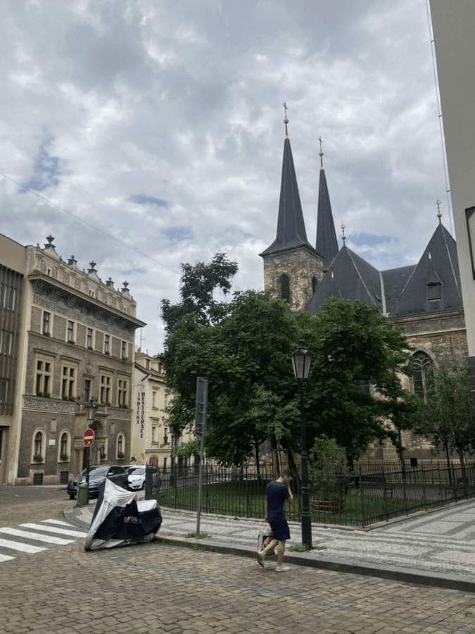
Around 1200, Vladislav Jindřich, Margrave of Moravia, allowed the Order of Teutonic Knights to move into the church, where they established a hospital.
Once Poříčí had been incorporated into the New Town, the church was reconstructed in Gothic style, starting in 1382, and not being completed until 1411 due to various complications.
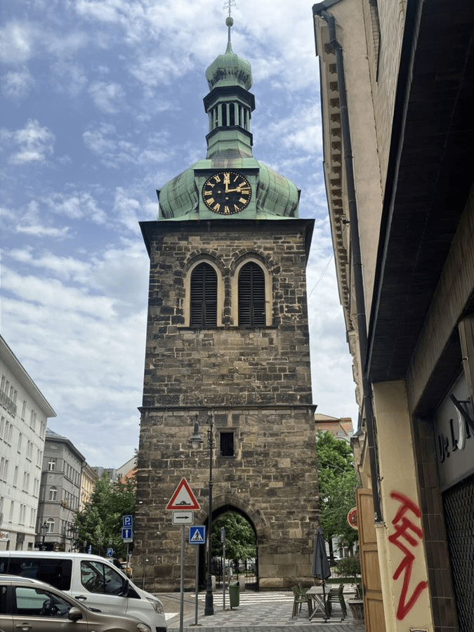
Surviving the Hussite Wars, further reconstruction took place in the 1500s, and a Gothic bell tower was added in 1598.
However, St Peter’s was ravaged when the Swedes besieged Prague in 1648, and would be damaged by fire in 1653, 1666 *and* 1680 (the 1666 fire came with a free serving of lightning).
This meant a long period of repair, beginning in 1686, and disturbed by yet another damn fire in 1689, as well as Prussian troops doing their best to ruin everyone’s good work in 1757.
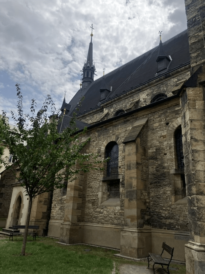
In 1874, an exhaustive – and expensive – full reconstruction was carried out by the architect Josef Mocker; it wouldn’t be complete until 1885.
There’s a statue of St Peter under the left tower of the church.
The bell tower includes three bells, named after Peter, Paul and John the Baptist.
The church also had a school and an ossuary, but both were destroyed in 1894.
On a non-church note, I have to give a shoutout to The Two Brothers, at number 12, an Indian restaurant whose food is so good that ordering it made parts of the early-2021 lockdown really not so bad after all.
The road originated in the late 1300s, and was initially called Štercéřská, after Oldřich Štercéř, a citizen of the New Town.
Zlato is gold; a zlatník is a goldsmith. And, along with the butchers, weavers, joiners, fishmongers, butchers, and, well, just look at every third post in the last two months,
They operated round here in the Middle Ages, with their first brotherhood being founded in 1324, and soon being promoted to guild status.
It was mainly settled by German merchants, as demonstrated by the name of the trade route leading through it – Vicus Teutonicum.
A second church, St Peter’s, was added in the mid-eleventh century, and by 1200, Soběslav II gave Poříčí the right to limited self-government.
The history of Poříčí as a separate settlement ended in 1348, when most of it was incorporated into Prague’s New Town.
Around that time, the street still consisted of two parts – the western side was called Slaměná, as straw (sláma) was sold around there, and the eastern side was called Šilinkova, after New Town mayor František Šilinek.
The two streets were united as Poříčská around 1850, then becoming known as Na Poříčí in 1894.
It’s a street that I mainly associate with errands and getting from A to B, but it deserves more attention than that.
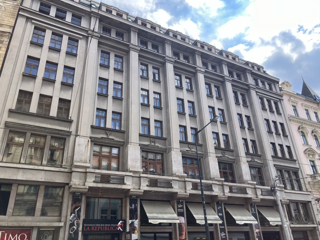
At number 12, there’s the modern classicist Palác YMCA, built in 1928 by the architect Eduard Hnilička. Originally offering 300 beds in 170 rooms, it was a secret meeting place for the Czech Resistance when the Nazis occupied Bohemia and Moravia.
The YMCA was forced to vacate in 1941, and was officially closed down in 1943; reopened after the Prague Uprising (in which it was badly damaged), it functioned again until 1951, when it was closed until 1991.
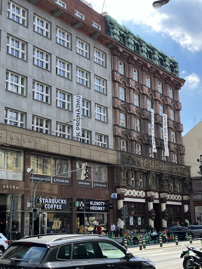
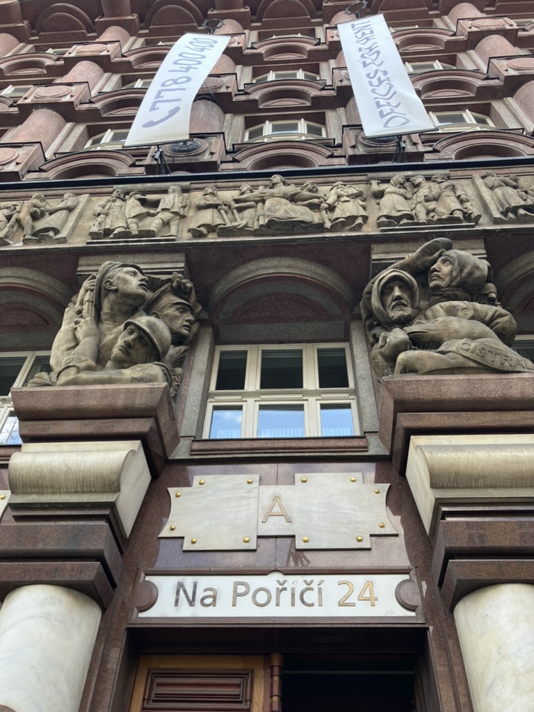
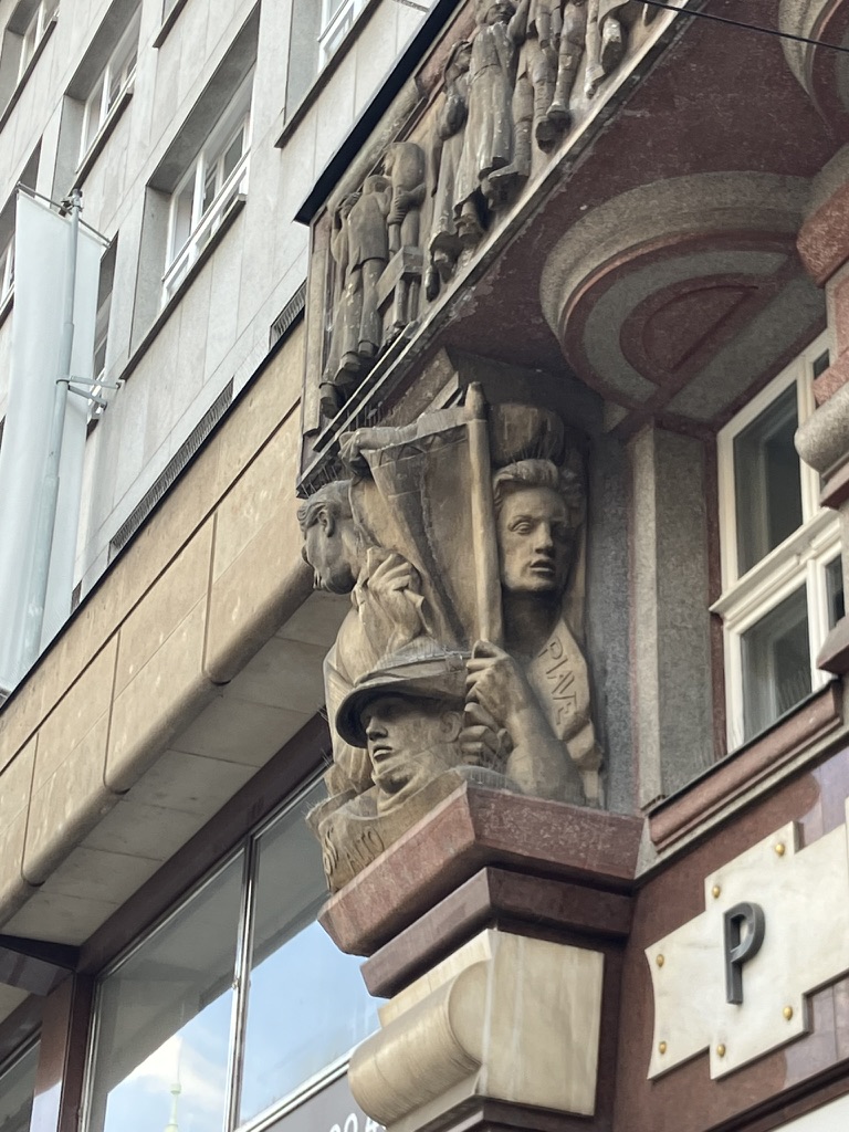
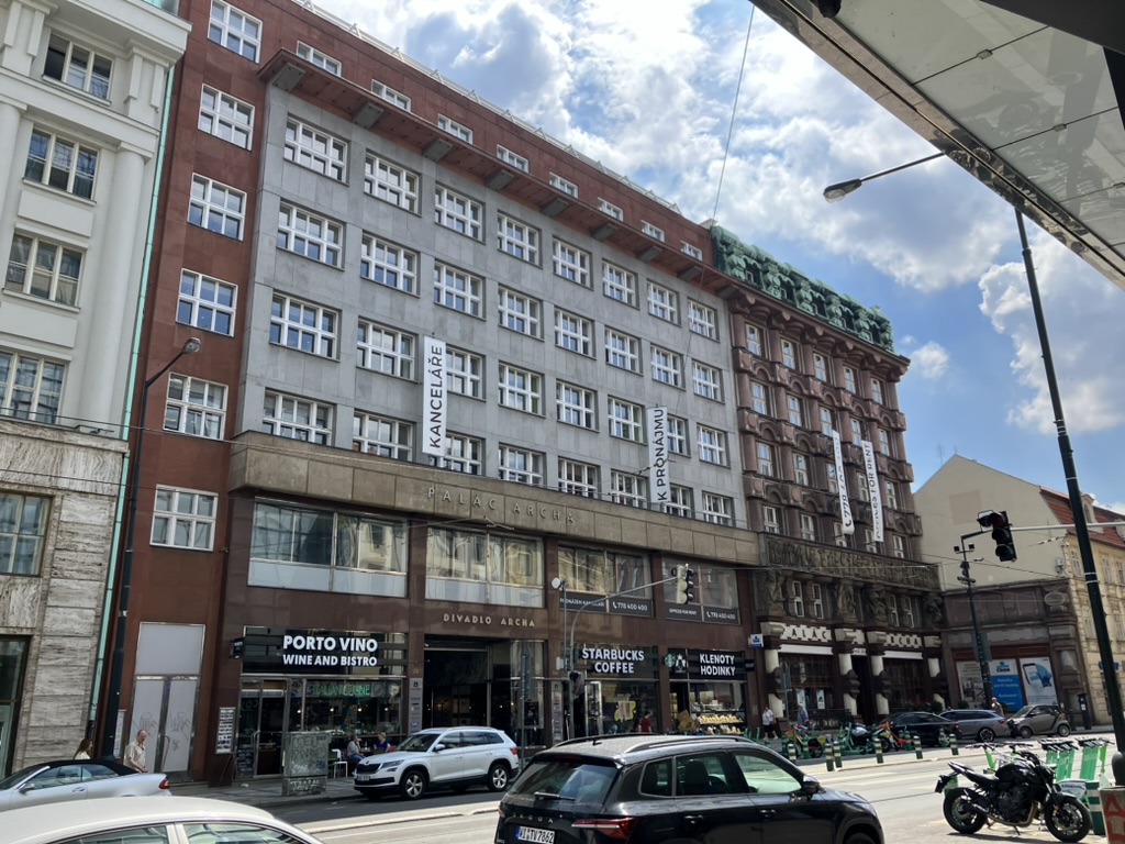
From 1937 until its dissolution, the Bank of the Czechoslovak Legions / Legiobanka had its headquarters in the rondocubist building at number 24, designed by Josef Gočár (on the right).
It’s called Palác Archa, and I’d happily start a Twitter account in which I publish nothing but pictures of its façade from different angles until the end of time.
It’s now used by Československá obchodní banka, a.s. (ČSOB), and, while I gather its insides are also quite spectacular, it’s closed at weekends, hence this rather disappointing photo.
Next door, there’s Divadlo (Theatre) Archa, which sadly closed down in 2023.
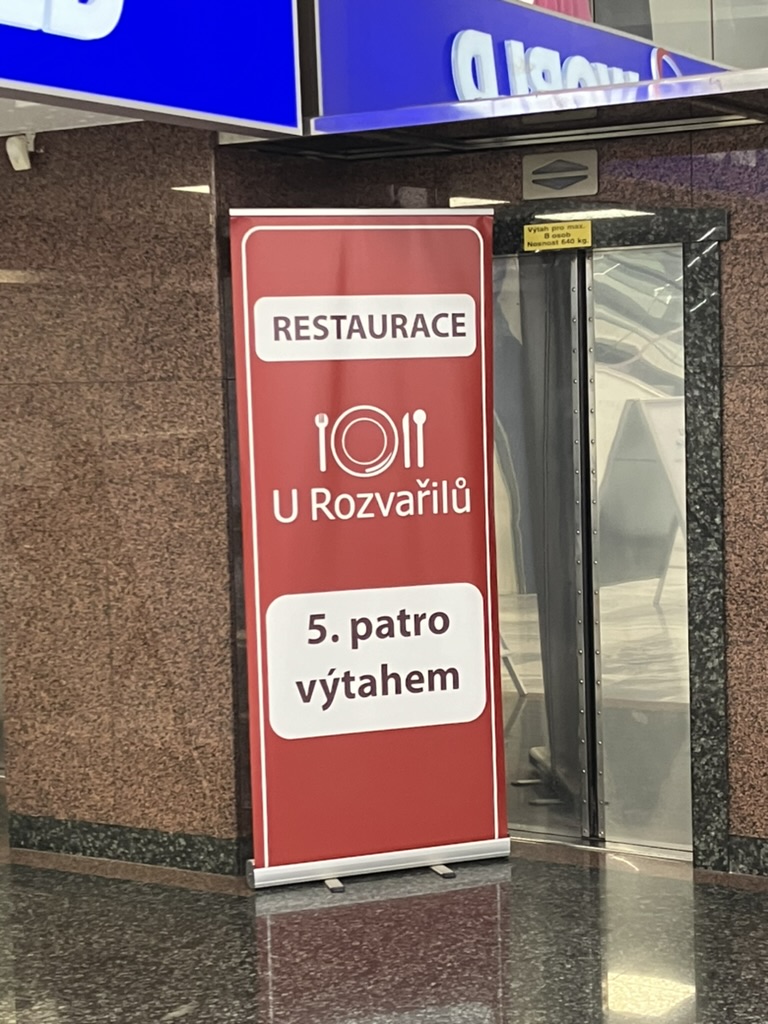
It was also once the home of U Rozvařilů, a restaurant able to trace its origins back to the 15th century. The restaurant (pictured in 1939) even had a cabaret for many decades, but was forced to move out by the owners of the building in 2008.
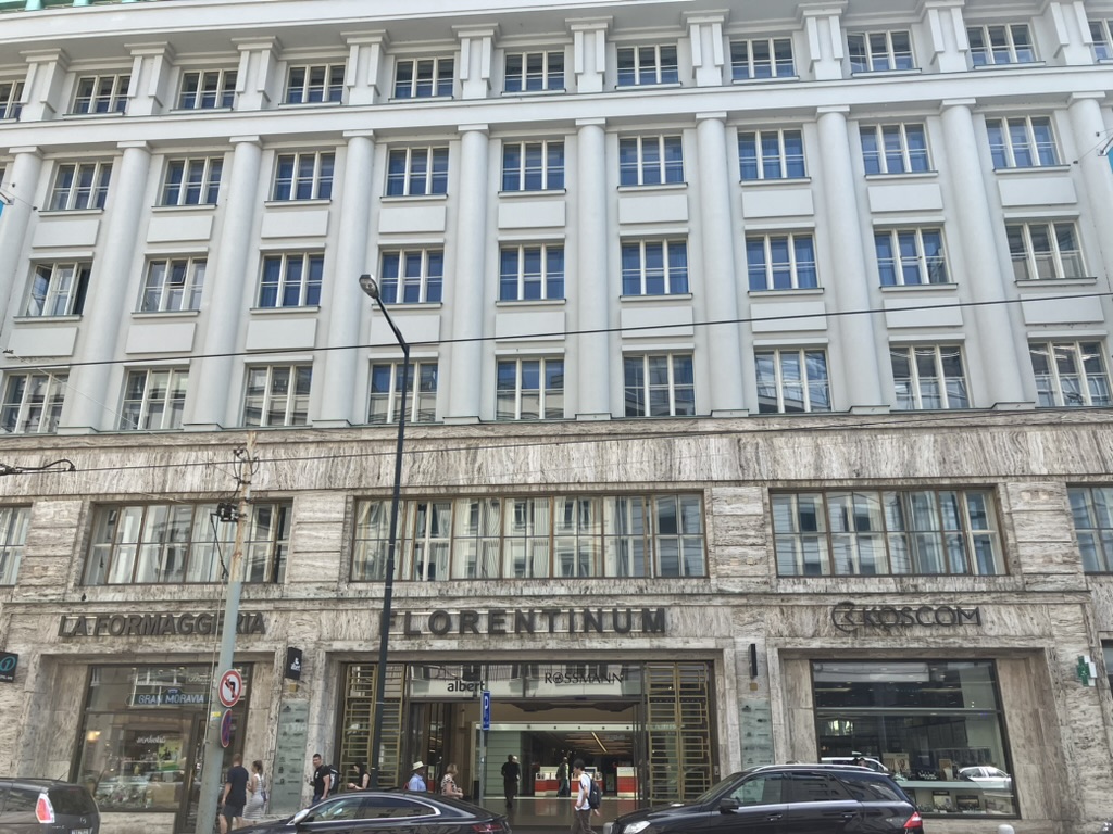
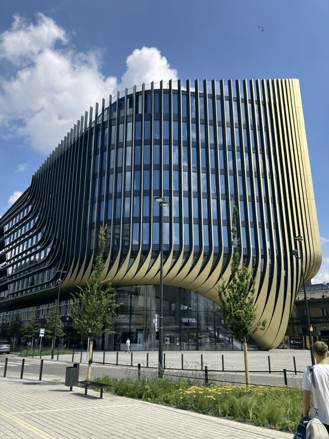
Number 30 hosts the Florentinum, a shopping centre, and also makes for a more imposing photo than you’d have thought.
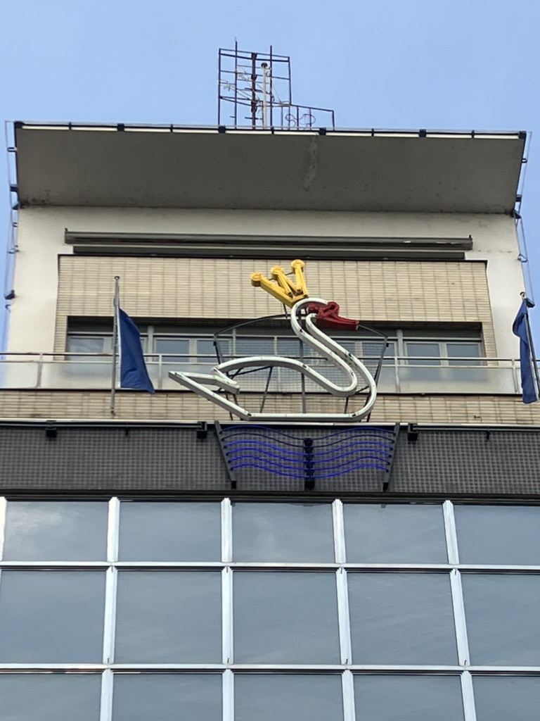
But, on the other side, there’s a much more famous shopping centre – Bílá labuť (White Swan), the most modern store of its kind in Central Europe when it opened in 1939.
It certainly can’t claim that title these days, but it did allow U Rozvařilů (see above) to move just across the road after being shut out of its long-term home in 2008, so that’s a good thing.
The insides aren’t really built in a way that allows you to take photos that show very much of it at once (not that this is the purpose of a shopping centre, I do realise).
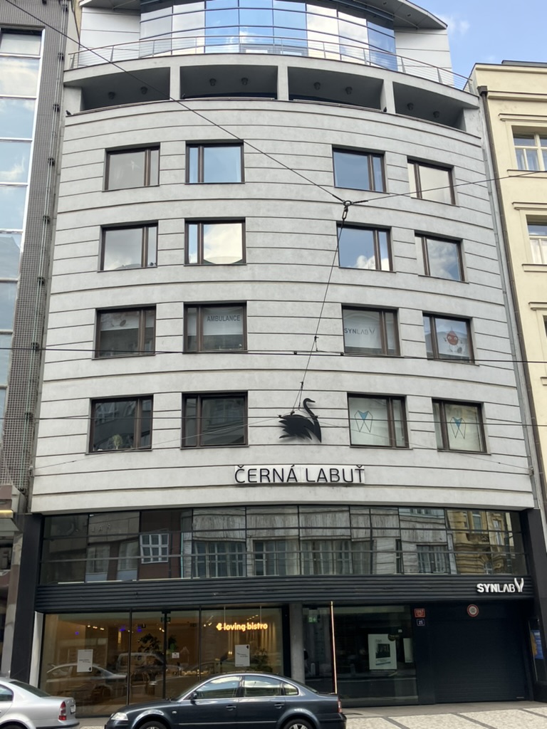
Pleasingly, the White Swan has a Black Swan as its neighbour.
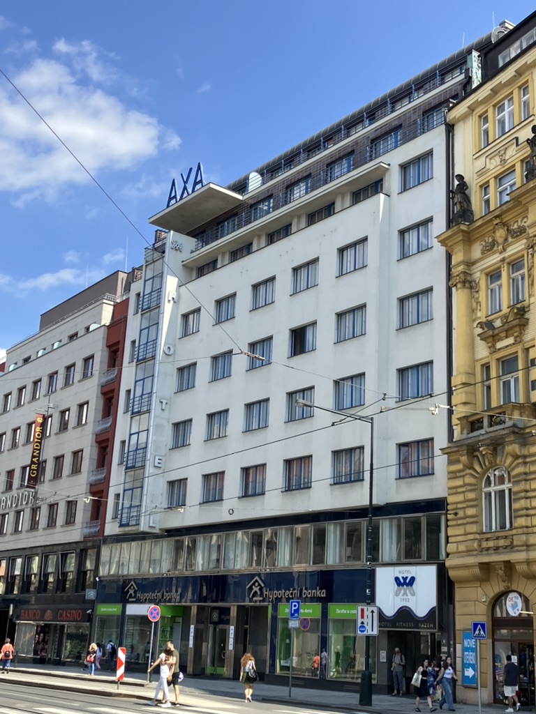
Continuing the functionalist feeling of much of the street, the Hotel AXA was built between 1930 and 1932 by Václav Pilec; it was returned to the family (specifically his granddaughter) in 1994, and renovated from 2013-4.
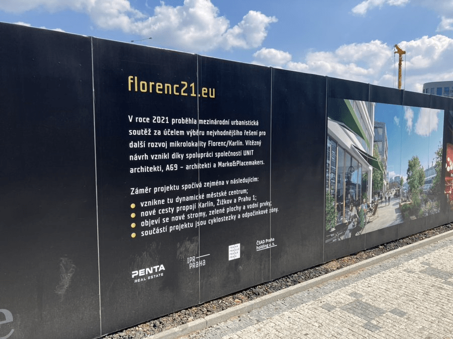
It’s likely that Florenc first appeared in or soon after 1348, when Charles IV founded the New Town and needed traders to settle in it – so he invited people from, among other places, Florence.
The name is first documented in 1392.
Florenc became an important transport hub when the industrial district of Karlín was developed.
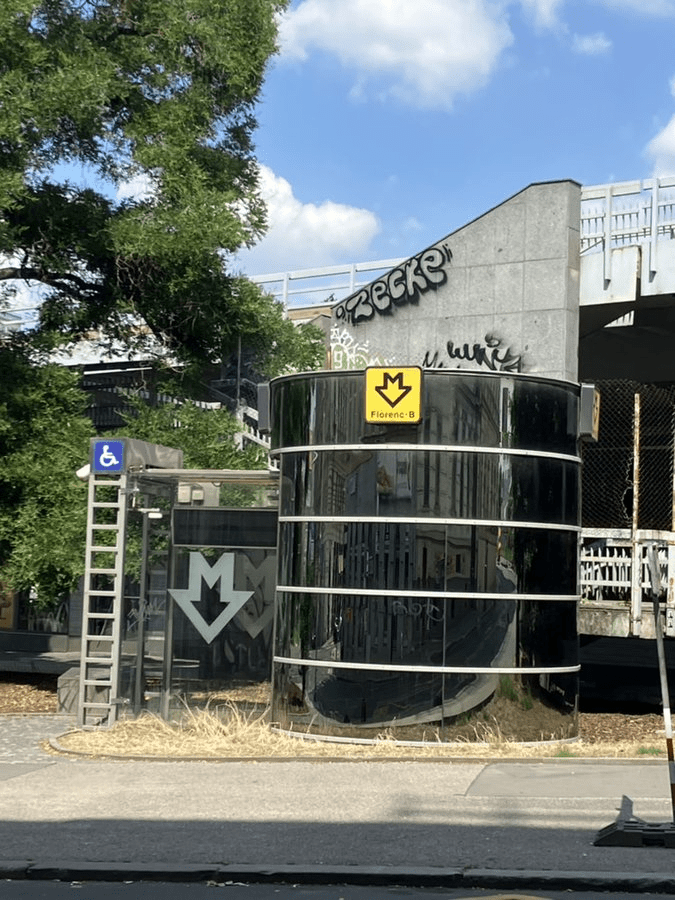
It remains known for its bus station and for being everyone’s third-favourite Prague metro transfer station (of three).
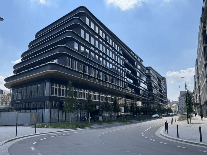
It’s hard to think of a street in Prague that has undergone more of a change in recent years, with the ongoing development of Central Business District Prague, or Nová Masaryčka, due to be completed next year.
Design of this building was supervised by the Iraqi-British architect, Zaha Hadid, shortly before her death in 2016.
It’s going to result in Florenc and Náměstí Republiky being more connected to Žižkov than they currently are, and increase access to the bus station.
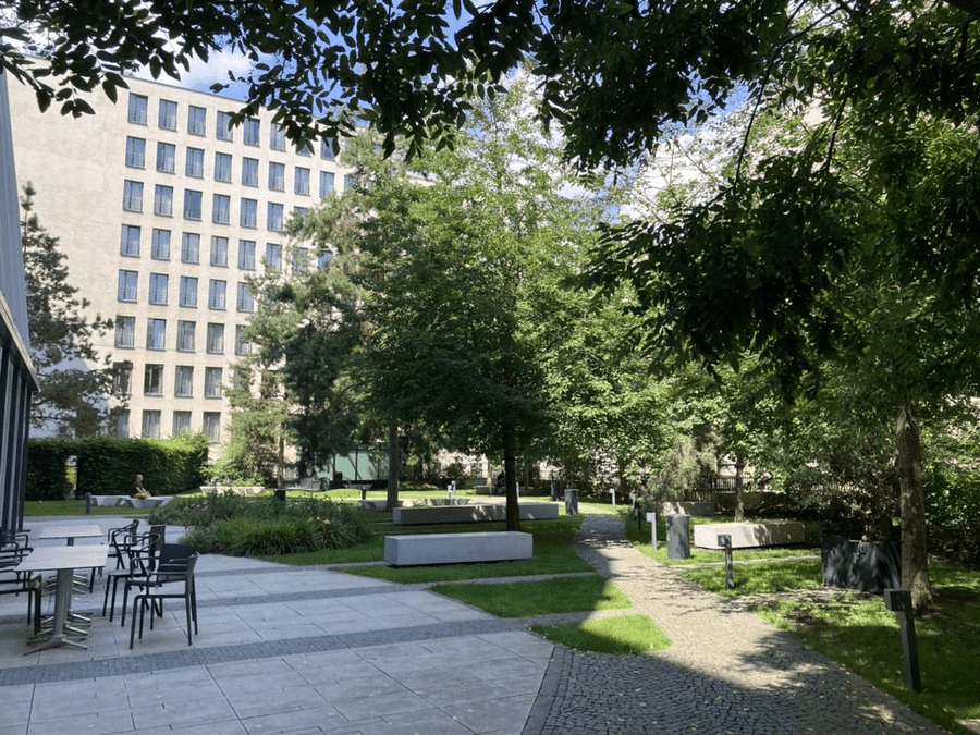
Na Florenci also features this quite nice park, located inside one of the business complexes; its shade and peacefulness (on a non-working day) are quite appreciated in the summer temperatures.
A quick diversion today – only 400 metres away, from one train station to another, because this blink-and-you’ll-miss-it street is one I, erm, blinked and missed.
Well, one side of it is – the non-pictured side is a rather unsightly car park.
One theory is that Bulgarians used to have own vegetable gardens round here; also (and unrelatedly), in the 19th century, there was a local pub called U Bulhara. The street, meanwhile, didn’t get its name until 1979.
We know that there were Bulgarian students in Prague in the 19th century – in 1862, they and their Czech colleagues founded a society, Pobratim, aimed at freeing Bulgaria from the Ottoman Empire and helping its church to independence.
Seven years later, another secret society, Postojanstvo, was set up for the same purpose, but in Tábor.
The first official society, Bulharská sedjanka, was set up in Prague in 1880.
However, the first wave of Bulgarian gardeners settling in Czechoslovakia happened in 1912-3, during the Balkan Wars, with further waves after WW1 and at the start of the Great Depression.
They mainly settled in Slovakia, but also in major Czech towns, where they formed horticultural societies.
These were liquidated by the communists in 1951, being forced to join an organisation named after Georgi Dimitrov, the first leader of Communist Bulgaria.
The 2021 census counted 7,679 Bulgarians in Czechia (versus 316 Czechs in Bulgaria according to the not-entirely-recent census of 2001).
Perhaps the most famous Bulgarian with a Czech connection was Christina Morfova (1887-1936), an operatic soprano who debuted in Brno and later joined the Prague National Theatre.
Originally, part of the street was called Florenc – more on that tomorrow – and another part was called Slaměná (‘sláma’ is straw, which was sold round here).
In the 1700s, the street became known as Blátivá, then as Na blátě, after the surrounding gardens – ‘bláto’ is mud.
The street was named after him forty years later, in 1896.
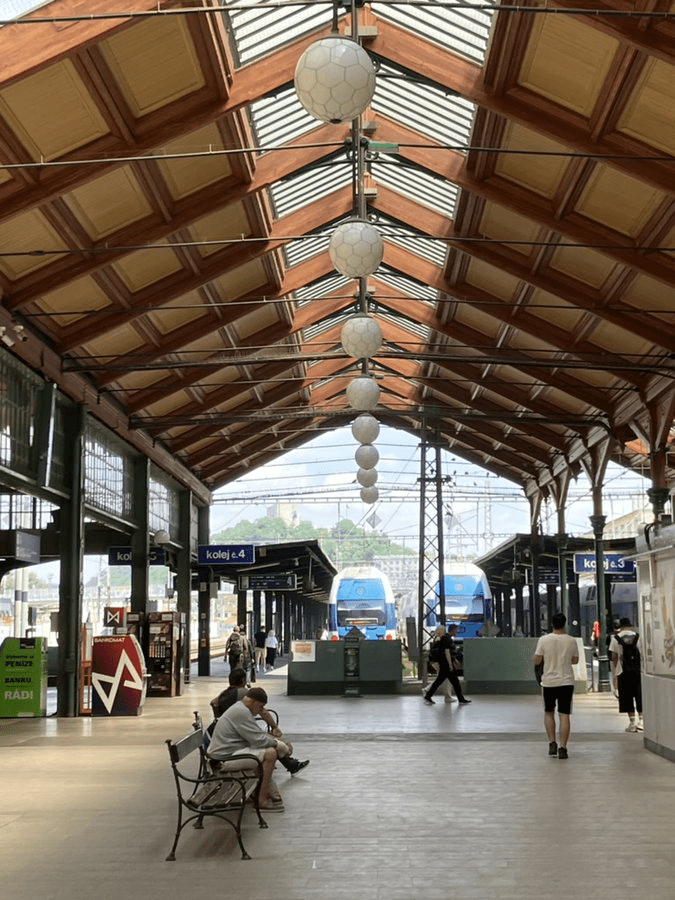
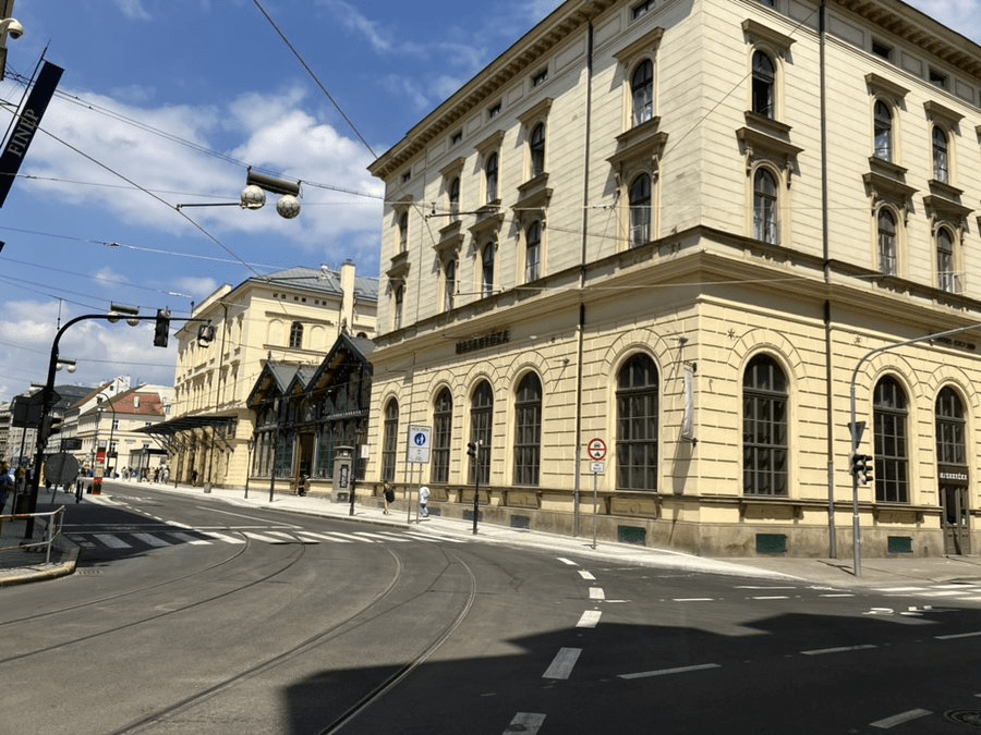
The most famous building in the street is Masarykovo nádraží, which, when founded in 1845, was the only train station in Prague (Dejvice, where there’s an older station, was not incorporated into Prague until 1922).
As such, the station was just known as ‘Praha’ until 1862, then as ‘Praha státní nádraží’ (Prague State Station) until 1919.
That said, the Communists managed to be both predictable and unimaginative by renaming it ‘Praha střed’ (Prague Central) from 1953 to March 1990.
One day, just one day, there will be a train from this station to Prague Airport, and to Kladno, although it feels like this has been spoken about since approximately the fall of the Great Moravian Empire.
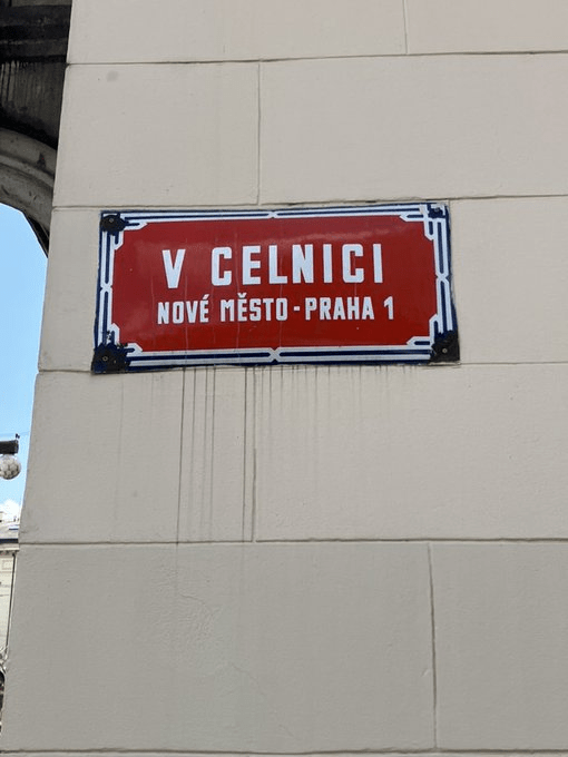
Apparently, it then moved to Haštalská (I need to verify this), but, by the early 1800s, the former Dům U Hybernů, which was no longer serving as a monastery (and is on the corner of this street), was chosen as the customs house’s new location.
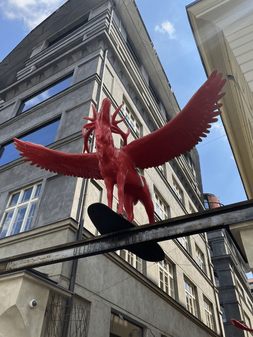
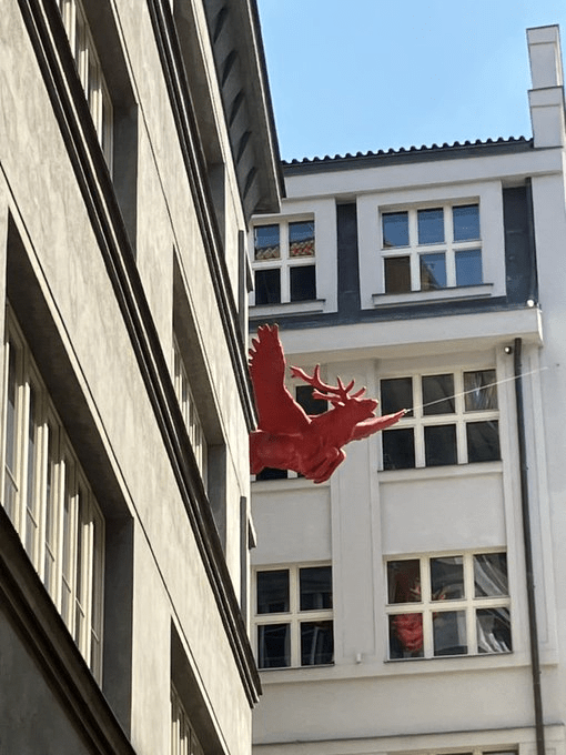
V Celnici also features Ulička sv. Hubert (St Hubert’s Alley), not an official street (indeed, its address is number 6 on V Celnici), but an alleyway with places to socialise. It’s most known for its red flying deer statues.